Αλόννησος – Sporades
Alonissos is a very quiet little island, located just to the east of Skopelos. It is primarily a destination for daytrippers from the nearby islands, who may want to escape e.g the rush of Skiathos for a few hours. This may change in the future, as this island is very well connected with ferries and hydrofoils the entire year. And indeed, package tourism HAS arrived even here. But Alonissos is probably not “attractive” enough for the general tourist to ever be spoilt by great hordes of people, and I guess it will retain its quiet rural charm, an easily accessible refuge for those who want to get away from it all. At least for now, it is a very idyllic place for some quiet and easy strolling around the Greek countryside, one of THE most charming places I have visited.
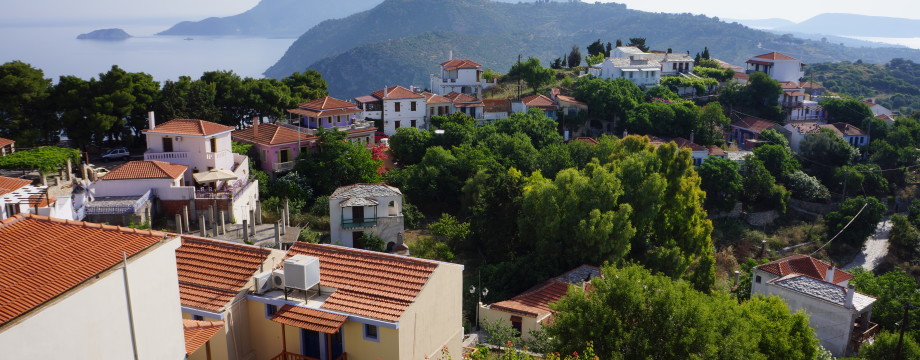
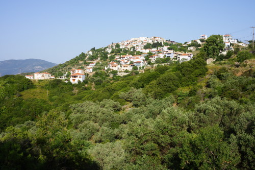
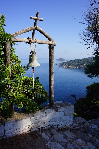
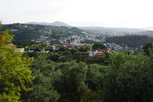
Alonissos also has the most excellent little hillside Chora. Currently it mostly consists of holiday homes, art galleries and trendy cafés that open in the middle of the day. After an earthquake in the sixties, the inhabitants left for the other villages closer to the sea, but it has now been largely rebuilt. It is a very nice place with great views over the island. If you don’t want to walk up there a bus does exist, but the walk is just as charming as the village itself.
Selected walks: For walks on Alonissos take a look in “Alonissos On Foot” by Bente Keller, available locally and on the web. I refer to the first three parts of this book below as “/Keller1/”, “/Keller2/” and “/Keller3/” respectively.
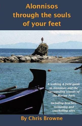
2015 Updates: The Keller book is getting rather outdated, but there is a new book by Chris Browne – Alonnisos Through the Souls of Your Feet: A Walking & Field Guide to Alonnisos and the Surrounding Islands of the Marine Park (from 2008, and with a 2nd Ed. from 2013) that looks promising. I do not own the book myself, but I had a peek at it (after my latest attempts at the walks on this page). I refer to this book below as “/Browne/”.
•1 PATITIRI – CHORA (my total time 0h34; 189a 10d; net walking time 0h31): This is Walk 6 in /Keller2/. A great little walk from the harbour to the old Chora and should not be missed. Just follow the main road up through the middle of Patitiri for a few hundred meters, then turn left at the sign. There is little ambiguity in the continuing path, crucial points are marked “4”. Close to the village you will rejoin the main road.
•2 CHORA – PANAGIA STO VOUNO – ROUSOUM (my total time 1h56; 208a 387d; net walking time 1h34): This is a small variation on Walk 13 in /Keller1/, ending the walk at the beach. After Panagia Sto Vouno I even walked the little track to the end, it ends at a driveway to a house. According to /Browne/ it seems you should be able to connect to a lower dirt road from here, but I have not tried this option myself. Instead backtracking, I returned to the main road. Here I did not retrace my steps towards the Chora, but instead set the course down towards Patitiri, just strolling along the road. There is not a lot of traffic on Alonissos, and the road is wide. Then it is left (signed) down to Rousoum. If you want to use the stair street you turn right just after the football stadium and then immediately left again and you will have the stairs on your right.
Just a couple of things to note about this walk. The church of Ag. Fanourios can only be approached from behind, the footpath from the crossroads is disused and overgrown. Instead use the road (left), and then take the first right.
You pass Ag. Sotiros with the church on your right, not left as the book says, and only in a couple of minutes, not ten as the book says.
The well cannot be recommended anymore. On my last visit (2015) the water both looked, smelled and tasted like sewage.
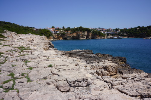
•3 ROUSOUM – VOTSI (my total time 0h42; 92a 80d; net walking time 0h35; the total time includes a few extra minutes of investigation): This is a variation of Walk 8 in /Keller2/, picking up the walk at Rousoum beach, and lastly including a piece of Walk 9. Be sure to discover the tiny steps right and subsequent narrow path just after the first few steps up from the beach. Do not turn at the little hut as the book suggests, instead continue ahead and right(ish) to get down to the sea cliffs themselves. Then round the headland counterclockwise by just walking on the pretty even cliffs until there is a pronounced stony path up left back to hut. This is a great little addition to the walk as described in the book.
From the hut you will now have to retrace your steps, the continuation of circling the headland has become impossible due to several new fences.
•4 VOTSI – AGII ANARGIRI – VOTSI (my total time 3h10; 413a 419d; net walking time 2h07): This is Walk 3 in /Keller3/, just starting at Votsi. Use your favorite approach from Votsi harbour (possibly via Rousoum on stair streets), to get yourself up to Hotel Atrium. Here you must note the “2004 Updates” above. Or use /Browne/. /Browne/ also has an idea of how to actually get to Mega Nero. I never got there myself, the path in /Keller3/ eventually diverted down right (even signed Mega Nero!) to the asphalt road, where by turning left I could just continue straight towards Agii Anargiri instead. The “2004 Updates” also made no sense to me at this point.
But following the street signs will soon get you back on track and the dirt road (initially) towards Agii Anargiri will soon fork off right. After that there are no problems, and you also follow signs, white crosses and yellow “5” markers.
On my way back I went as straight as I could back to Votsi after hitting the first asphalt road, just following the street and disregarding all instructions. They stopped making much sense at that point anyway.
•5 PATITIRI – KATO HORAFI – PATITIRI (my total time 1h13; 193a 193d; net walking time 0h53): This is Walk 10 in /Keller2/. Just note that dirt roads mentioned in the book are now all tarmac, so use the map carefully instead of caring too much about the instructions in this respect.
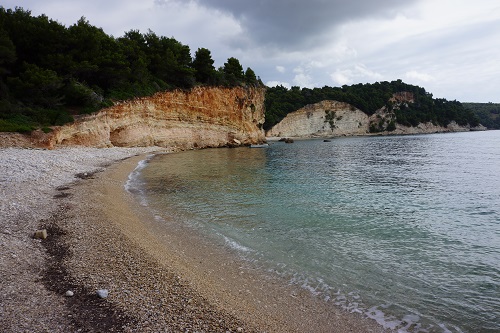
•6 PATITIRI – SPARTINES (my total time 0h52; 127a 126d; net walking time 0h42; both the net and the total time includes a few extra minutes for investigation): This is Walk 5 in /Keller2/. The beach was actually rather scruffy and uninteresting.
The path down from the church (into an olive orchard) is disused and so faint it can hardly be seen. If you want to use it veer left so you can see the track coming down behind the trees left of the orchard. It is better to use the track all the way, and this is also signed to the beach. As you can see on the map you will then have to take a left from the main street and shortly fork right.
• Good starting points: • Patitiri (the island’s port) – Many walks starts here and you can take the bus or walk up to the Chora • Chora – Many walks starts here
• How to get there: • Excellent ferry/hydrofoil connections from the other islands in the Sporades • By ferry/hydrofoil from the mainland
• More info: • Alonissos island information – a site by the Ikion Hotel that has interesting information, pictures and links
This page was last modified at February 12, 2026.
©1997-2026 .