LISBOA – Portugal
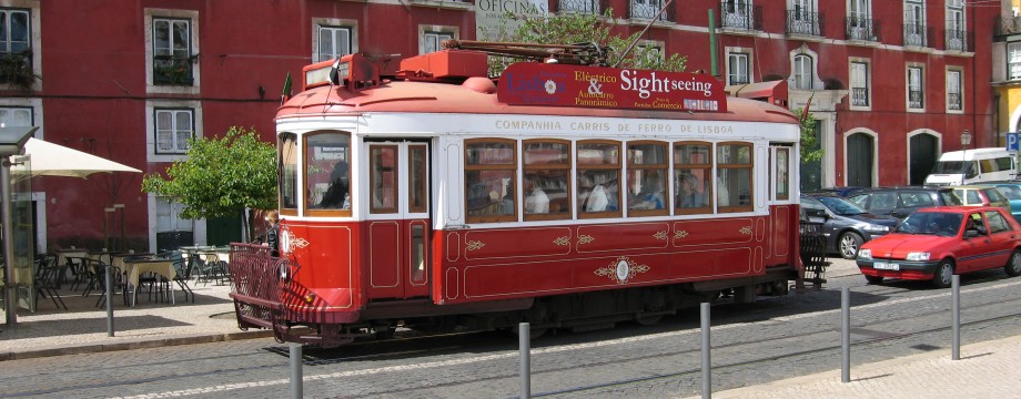
Lisbon is very nice for a city, and has some at best wonderful walks in the area as well as in the city. Public transportation is great, so it is very easy to get around.
Around Rossio is a very convenient base for transportation to the walks described here and there are many good hotels and restaurants in the neighborhood. The back streets east of Praça Los Restauradores for instance has myriads of nice, simple and inexpensive places, and I can really recommend fish and seafood which is always fresh and cheaper than anywhere I have ever visited.
Selected walks: For walks in and around Lisbon take a look in “Walk & Eat Lisbon” by Paul and Denise Burton, referred to below as “/Burton/”.
•1 SINTRA (my total time 3h53, includes stops for photography and only the minimum of sightseeing, as well as some “research” and standing in queue; +568m -546m; 3 laps): This is walk 2 in /Burton/. My timing starts at the train station, and ends and Café Paris on the return. A wonderful walk, but requires intense concentration on navigation, as there are so many details in the walk description. Mind that in addition to the buses mentioned in the text you can also take bus 435 to historical centre of Sintra to start the main walk (all these buses stop just outside the train station). But it is actually a nice addition to walk this short stretch. Just follow the road signs.
The instructions after the revolving gate (13min) has confused many, as can be seen from the updates on Sunflower’s web site. The 10 meters referred to is actually correct, just the first turn (zig) is to the LEFT. Then zag to the right and up… But there is nowhere else to go anyway at this point.
At the first Visitor Centre (24min) be sure you buy a combined ticket to both the castle and the palace HERE! I did the mistake of not doing so and then spent half an hour standing in line at the tiny ticket office below Pena Palace instead, where there was a slow moving 50m queue…
After visiting the palace the instructions in the book are really confusing, and I spent a lot of time “researching” what was actually meant here. You get the impression that you are supposed to take off for a couple of minutes from your original route up to find this Picadeira area (44min). Instead this is actually the picnic area with benches and a pavilion that you passed immediately to the right of on your way up. The area was not signed in any way. Just retrace your steps to this point.
Be sure to read the updates for useful added directions from Fonte das Passarinhos.
•2 VÁRZEA DE COLARES – AZENHAS DO MAR – PRAIA GRANDE – VÁRZEA DE COLARES (my total time 2h42, includes stops for photography; +-181m; 2 laps): This is walk 5 in /Burton/. The walk in itself is perhaps only medium interesting, but the coastal landscapes are very nice.
No navigational problems en route, but be sure to get off the bus at the right spot. You will probably not notice the name Várzea anywhere, but alight immediately when you see the (brown) roadsigns for Azenhas do Mar etc. This is actually the last bus stop before the road exits the Colares village limits.
Also, the book says you can use bus 403 and 441 (both are correct) from Sintra railway station (this is NOT correct). Both buses can be taken from Portela de Sintra (where you find the main bus terminal), only the 403 bus can be taken from immediately outside the train station. You should however be able to pick up the 441 bus from the bottom of the pedestrian street in Sintra, where it must pass.
This is also crucial information of you want to do walk 6 in /Burton/!
•3 LISBON CITY WALK (my total time 3h40, includes stops for photography, a minimum of sightseeing and a cup of coffee; +221m -230m; 1 lap): This is walk 1 in /Burton/. My timing start at my hotel, close to Praça Los Restauradores, and ends at Praça Dom Pedro IV, after skipping the Elevador when I saw the amount of people lining up for it. It was lunchtime anyway… Careful navigation is needed even for this walk, as there are so many tiny streets and alleys in Lisbon… Also be sure to start fairly early (9-ish should be sufficient), otherwise, by the time you get to Castelo de Saõ Jorge, the line for the ticket office will be 100m long. I am not kidding. Also bring a wind jacket for the castle… Observe that the text and the map does not coincide for a short stretch after waypoint 21.
•4 PENINHA (my total time 1h53, includes stops for photography; +-303m; 1 laps): This is walk 4 in /Burton/. An easy walk, but navigation was not that easy. Unfortunately these tracks (and even the paths!) are also loved by mountain bikers, and that really detracted a lot from the otherwise peaceful and idyllic mood of the place (at least on weekends). Even quite dangerous, as these people have no concern for others…
I was unable to spot where the path went into the woods and continued on track until the path crossed again, after I took what I now know is a later left fork than the one mentioned in the book!
A quick look at Google Earth confirms all this: The correct left fork (as the TEXT actually correctly states) is a very overgrown (on my visit) track going EASTWARDS and in contradiction with the MAP tracing, where there are eventually two forks after you go in a WESTWARDS direction. This is wrong, the fork is just over the watercourse, and goes left IMMEDIATELY.
I found it very difficult to figure out where I was related to the text or map, as also only one of the watercourses that are visible on the map could be seen in practice. It is now obvious the fork I took was the wrong one at the SECOND watercourse, which is not mentioned (as a watercourse) in the text. But as the map is plain wrong here it is not so strange I had these problems matching it to the text. Usually I follow the map most closely when I am in doubt, or when text and map seem to diverge, but here for once this was a mistake. Another problem is that the path does not actually rise noticeably before just after the second watercourse either, yet another point where the book was misleading…
Anyway, I just continued uphill in more or less obvious directions, and it worked for me in the end. My net walking time was still as in the book.
Luckily the tracks followed downhill again later did not have any problems.
• Good starting points: • Rossio area, with Rossio station, is perfect
• How to get there: • By air
• More info: • Carris has timetables for local buses • CP has timetables for trains • Rede expressos has timetables for the red express buses • Scotturb has timetables for local buses around Sintra
This page was last modified at March 4, 2026.
©2009-2026 .