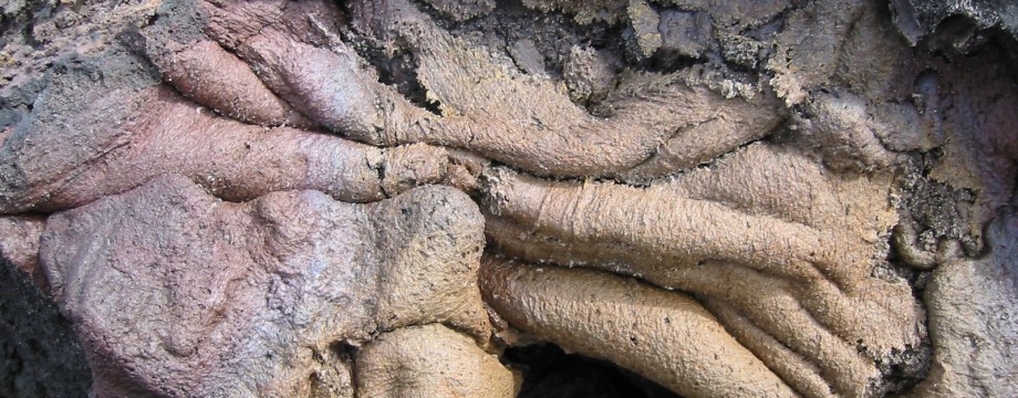
LANZAROTE – Canary Islands
Lanzarote is another “very volcanic” island, situated just north of Fuerteventura. The island does not have the large mountains of most of its sisters, but instead offers mostly easier walks in an, even here, pretty spectacular landscape. At least it has more to offer to the serious walker than Fuerteventura.
In Playa Blanca, your untiring guide has of course checked out the menu of every food outlet in town. They all seemed to serve the same… But if you want something a little bit more special, you can have quails (“Hunter’s style”) at Terraza Pedro by the sea (UPDATE: I have not checked out the actual existence of this restaurant for years…). That was the most interesting course I could find, but be warned that their level of service strangely resembles sleight of hand. By the way, have you seen the movie “Eraserhead” by David Lynch? Just kidding…
Arrecife may not be that interesting for eating either, but I have found a couple of very nice places: Tasca La Raspa and El Nuevo Maccheroni. Although I have not actually eaten there, the restaurant at the Castillo de San José (a bit out of the centre of town) looks like the most elegant but still relaxed place you could ever want. No T-shirts in the afternoon!
Note that the bus line(s) (currently 1, 2 and 3) from Costa Teguise to Puerto del Carmen via Arrecife (and vice versa) is all the same bus.
Selected walks: For really good walks on Lanzarote take a look in Noel Rochford’s Landscapes of Lanzarote, referred to below as “/Rochford/” (PLEASE NOTE: when I refer to walk numbers etc. from this book they are all taken from the 6th edition). Discovery has book you should check out, see Walk! Lanzarote, by David and Ros Brawn. There is also Walking in the Canaries Volume 2 by Paddy Dillon. On the web visit The Canary Island of Lanzarote – Hiking Ideas for walks on the Island with photos by Foxy’s Island Walks.
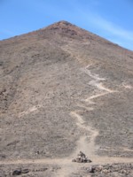 •1 MONTAÑA CORONA (my total time 2h45; 416a 412d; net walking time 2h32). This is Walk 23 in /Rochford/, but using basically all the alternative paths (some even twice and partly in reverse) to avoid as much road walking as possible. The (alternative) path actually materializes at the crossroads (at the right hand side of the road) way BELOW the Hotel Beatriz, so I recommend following it from there. I have also in the past done the original main route, including the “plunge” straight down at the end. I cannot really recommend that route…
This is a dramatic little walk with immense views. From Costa Teguise the “waymarks” are omnipresent, so if you actually read the book you just cannot go very wrong, the Hotel Beatriz is positively HUGE. The descent from the volcano is very steep and rough and potentially dangerous, even with the slightly less steep alternative option down. Bring a walking stick! If I ever do this walk again I will do it in reverse (or walk the same way back). After the descent I reconnected as directly as possible with my incoming route, there is no use ascending unnecessarily and roughly up to the large cairn, NOR going too early down to the road. “My” connecting path is clearly marked, but unused, on the map in the book.
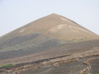 •2 UGA – MONTAÑA DE GUARDILAMA – PUERTO DEL CARMEN (my total time 2h51; 358a 549d; net walking time 2h32). This is Walk 14 in /Rochford/. Mostly an easy stroll, with a small mountain to ascend/descend for fun. That part of the walk is actually easier than the description in the book might lead you to believe. However, for reasons to follow I unfortunately cannot recommend this walk in its entirety any more. Luckily there are several other alternatives. Note that my walking times above does not include the mountain, as on my last visit I cut this out due to approaching rain. I have done the entire walk in the past though (+529m -677m; net walking time about 3h30).
Most of the walk is pretty easy to follow, but taking the “CAMINO DEL MESON” down is potentially unsafe due to the possibility of several loose dogs, and one VERY AGRESSIVE one in particular. Note that approaching the “CAMINO SAN PEDRO”, the text in the book does not match the map. The map is correct of course. As fairly clearly seen on the map you CURVE left on the main track (there is a lesser track going straight on to some buildings or small farmstead), then taking the tarmac lane CAMINO SAN PEDRO to the right.
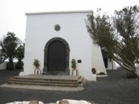 •3 HARÍA – TEGUISE (my total time 2h54; 427a 386d, net walking time 2h51). This is Walk 8 in /Rochford/. An exhilarating walk and a real leg-stretcher if you want. CAREFULLY follow the instructions in /Rochford/ to find your starting point and directions out of Haría. Note that the indicated street name (“CALLE EL PUENTE”) in the book is actually incorrect. That one is just another tiny side street going left again from the CLEARLY SIGNPOSTED correct street. So not much of a problem.
After a safe ascent to the restaurant it is mostly go, go, GO…
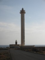 •4 LA HOYA – FARO DE PECHIGUERA – PLAYA BLANCA (my total time 4h47, includes time for photography, a short lunch and a dip in one of the rock pools; +230m -255m, 0 laps). This is Walk 28 in /Rochford/, but in REVERSE, with the addition of a stroll into Playa Blanca. Initially follow the instructions for walk 22. Hardly any navigational problems on this walk.
The descent into the ravine close to the start was not as difficult as described. At most points this walks is just following the map and picking a path or track of your liking. The promenade from Playa Blanca now almost goes all the way to the lighthouse (picture right), and makes a pleasant stroll at the end.
OBS: I did this walk last in 2003!
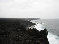 •5 MANCHA BLANCA – PLAYA DE LA MADERA – TINAJO (my total time 5h57, includes time for photography, a short snack break and a dip in one of the rock pools as well as other “sightseeing” on the coastal path beyond Playa de la Madera; +331m -382m, 1 lap). This is Walk 12 in /Rochford/, expanded by the first 10-15 mins of Walk 30, the Timanfaya coastal path (picture left). Another leg-stretcher, no navigational problems if you follow the guide. At the end of the walk, entering the big crossroads in Tinajo, I would suggest you go RIGHT, to pass a couple of friendly restaurants, before another bus stop something like 100m further on.
OBS: I did this walk last in 2003!
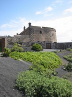 •6 ARRECIFE TOWN WALK (my total time 2h50; 144a 139d, net walking time 2h21). I can warmly recommend doing a stroll from the Playa del Reducto / Intercambiador bus station (via the nearby park) to the Castillo de San José and back, maybe spending some time at the Castillo de San Gabriel museum, the San Ginés church, El Charco de San Ginés, or the Castillo de San José itself (picture right) with its gallery of contemporary art and its splendid bar/restaurant. Make sure you circle the entire Charco de San Ginés as part of your walk (minus the two pieces you cut off by using the walk bridges). This is also an excellent place to stop for lunch on your way back.
•7 ARRECIFE – PUERTO DEL CARMEN (my total time 3h08; 202a 193d; net walking time 2h51): A surprisingly useful walk/longer stroll. Start at the park by the Playa del Reducto / Intercambiador bus station in Arrecife and just continue on the promenade all the way to Puerto del Carmen. Start early if you want avoid most tourists. You can shortcut and do some parts of the walk on seaside paths.
• Good starting points: • Playa Blanca, a few walks in the area • Puerto del Carmen, a few walks in the area, not that I would actually RECOMMEND anybody to stay at this kind of resort • Arrecife, for a REAL walking holiday, if tourist activities are not of first priority, you will easily get around the whole island by bus
• How to get there: • By air • Some ferries from other canary islands do exist
• More info: • Bus timetables can be found here • Lanzarote Canary Islands, a virtual travelguide • Lanz@rote.com, “All about Lanzarote!!” • The Canary Islands – Lanzarote Holidays, Beach Guides, Walks and Photos by Foxy’s Island Walks
This page was last modified at May 25, 2017.
©2003-2017
