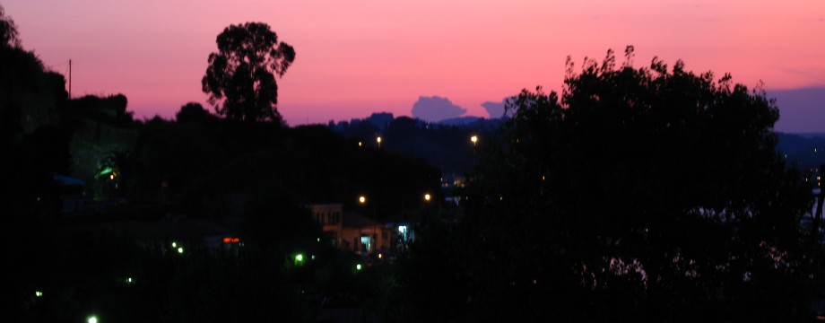
Κέρκυρα – Ionian
Corfu is one of the greenest islands in Greece. It is amazing how many shades of green that actually exist here. The island has a very varied landscape, from steep mountains to stretches of sandy beaches that resembles what you can find on some of the Canary Islands. But what strikes you the most is its many a picturesque coastline and the beautiful scattering of cypress trees. Should be something for everybody here.
Unfortunately large stretches of coastline has been more or less destroyed by over-development. I guess you would have to go all the way down to Crete or Rhodes to see something worse among the Greek Islands.
For walking it is most practical to stay in the surprisingly pretty Corfu Town. Bus connections are good, and you will get around to every part of the island. Some has lamented the chaos of the green (long distance) bus terminal. Strange, because I have hardly used more than a minute to find my bus, ever. All the buses are clearly marked, and fixed positions are assigned for departures to the most frequent destinations. Seems very well organized to me.
One bad thing about the town is that it is expensive. Its exclusive appearance and clientele have made this rather sophisticated town one of the most expensive places in Greece. Another thing is that it IS a town and it has lots of hostile streets and noise, although some of the prettiest streets are pedestrian. Assholes on motorbikes and scooters go everywhere of course. But as long as you will be out walking or at the beach just about every day, it should be bearable.
It pays off getting a nice hotel in a busy place like this. A few cheaper hotels are close to the ugly new harbour, but you won’t like it there for a whole week or more. So if you plan on staying for more than a couple of days, e.g the old harbour is a better choice. The C-class Constantinopoulis turned out to be a very nice place in 1999. It was totally renovated, had friendly service, and was well worth the 11000 GRD per night (including breakfast) that they charged for a single room (mid-season tariff) at the time. In 2009 the Constantinopoulis was full, so I selected the even better B-class Astron, which is even nicer. The room smelled of soap and clean towels every time I entered (so much different from the smoke-filled Arcadion where a non-smoking (!!!) room was absolutely stinking). From the harbour, and with a room with a view, you can also watch the impressive Pantokrator and its range of mountains across the bay (more than 900m to the top). In 2009 the harbour itself was under refurbishment (funded by the European Regioanal (sic!) Development Fund, no less…) and was more noisy during the day-time than usual.
Selecting places to eat also needs care. I initially used all the help I could get from the usual guide books. But I must say that a couple of the originally recommended food outlets really has fallen from grace. “Dionysos” had bread with mould and an oxidized red house wine. “Naftikon” served old fish at premium fresh fish prices. Instead try Spilia (for pasta and other Italian fare), Taverna Pergola (Agia Sofias 10) or “Moyragia Ouzeri and Snack Bar” on Arseniou. All these are in the area behind or close to the old harbour and therefore have reasonable prices. Close to the much more expensive Liston, “Restaurant Rex” also has good value for money, but is today in a totally different class. WARMLY RECOMMENDED. In Paleokastritsa try the “Astakos”. I have had some truly excellent Pastitsio there. The best ever?
A word about Beer. Corfu has its own microbrewery called (surprise!) Corfu Microbrewery. I have tasted their “Lager” (fairly light) and “Pilsner” (very nice and very well balanced!) which you can get in supermarkets and better bars. They also have some ale that I was currently not able to find anywhere.
Selected walks: For walks on Corfu take a look in Noel Rochford’s “Landscapes of Corfu”. All references below are to this book (as “/Rochford/”, and PLEASE NOTE: when I refer to walk numbers in this book they are taken from the 5th edition).
There is also this walking guide sold locally by Hilary Whitton Paipeti.
Lance Chilton has a booklet called “Walks in Northwest Corfu”.
•1 KAMINAKI – ELOURGIA (my total time 5h28, including a couple of swims and a couple of snack bars…; 617a 544d; net walking time was only 2h44): This is Walk 4 in /Rochford/, going to “Kendromadi”.
A very nice walk with some rough parts. Although I have reason to believe the scrambling bits are easier today (2009) than ten years ago, I took my own advice below. At least the overgrown path by the water pipe had been cleared and even signposted from the road above! For what it is worth today these are my original notes:
“From Kerasia you are recommended to take /Rochford/’s advice on how to avoid scrambling further on by taking the track from the taverna to Ag. Stefanos. You will have to use the track for about half of this stretch anyway. But the initial path was so good and the landscape so lush that I could not resist taking the path by the shore. This takes you to a steep descent down to the next beach. From there it is no path further, and the scrambling begins. I must admit that this part of the route was very tough going. Progress at some points will have to be slow, if safety is an option. At the tip of the headland you climb a steep narrow path towards a house up on the hill (See a black water pipe a yard or two before the path). After a few yards the paths forks. Clamber down to the beach again on the right fork. It is even signposted for Ag. Stefanos. And the scrambling goes on. You my even have to wet your feet at some point. Finally you will manage to get yourself to the next cove, where you pick up an overgrown path by another black water pipe (mentioned in the book) to crush your way through the bushes up to the track. Luckily no thorns. Phew!!!”
From Ag. Stefanos you do not need to walk the road for the entire way. There is a (signposted to Artabani) shortcut just above the resort where a side road goes left to two churches.
Another option from Ag. Stefanos is to continue along the coast on new public footpaths into the Erimiti wildlife reserve.
•2 PALEOKASTRITSA – LAKONES – MT. ARAKLI – MAKARADES – KRINI – ANGELOKASTRO – PALEOKASTRITSA (my total time 4h19, including a small breakfast; 748a 753d; net walking time 3h11): This is Walk 12 in /Rochford/.
This excellent walk has so many thrills that even if it is slightly strenuous I am tempted to say that EVERYONE SHOULD TRY THIS WALK! There was however one big let-down on my latest visit, see below, hopefully a one-off.
Not much trouble finding my way on this walk, mostly pure delight. On the return, by the souvenir shop where the slightly rough descent down to Paleokastritsa begins, the initial stairs are hidden by a driveway to a new building on the right. Walk a few paces down it, turn left and find the steps. They lead down to what is today a fairly nice path.
WARNING: On my way back down to Paleokastritsa I was attacked by a crazy dog that a stupid kid just let out through the gate to some holiday villa. The dog was big enough to be dangerous. Luckily I wear solid boots. The next time I do this walk I will be even better prepared and kick this dogs teeth in if it shows its ugly face again.
•3 AG. GEORGIOUS – ISSOS BEACH – AKR KONSIA – LAKE KORISSION – AG. GEORGIOUS (my total time 2h17, including a small swim; 176a 178d; net walking time 1h40): This is a very small part of Walk 20 in /Rochford/, with (attempted) beach life added. Use the map to find your way. When the going gets tough shortly after Akr Konsia there is no use following the beach any further. Then go back as much as needed and cut straight towards the lake.
Currently (2009) I cannot recommend this “walk” at all. Ag Georgious (the southern one) itself has today become the positively filthiest and ugliest place I have ever visited in my walks. The absolute bottom of the barrel. If you want to research what selling the cheapest charter trips does to a place this is a case study. The formerly unspoilt beaches are strewn with litter (as there are no garbage bins) and the food in restaurants potentially lethal. At all cost stay away from the restaurant “Palladium”.
The stop for your returning bus is a few hundred meters further along the road (from the T-junction). When you came the bus probably stopped at the T-junction. Take care to get away from there without too much harm done…
•4 PIRGI – SPARTILAS – TAXIARCHIS++ (and return) (my total time 5h, includes only short stops): This walk consists of the last (optional) part of Walk 9 (in reverse) plus the Short Walk 1 version (a bit extended) of Walk 7 in /Rochford/.
I have not done done this walk since 1999! You should be able to cut almost straight across the gravel track at 700m and continue directly towards Pantokrator if you want. I did not see (let alone try) that option on my visit. For what they are worth today here are my original notes:
“Straining my sadistic tendencies to the utmost I have constructed this hellish test just for you. What about starting out at sea level and see how far you can get up those hill sides, remembering that you will also have to return the same way? If this sounds appealing to you, be my guest and give it a try. There are over 900 meters all the way up to Mt. Pantokrator. The new gravel road weaving its way at about 700 meters will be more than sufficient for most. It was enough for me, anyway. The route from Pirgi to Spartilias is just an hours warm-up exercise, with some road walking, but you will be able to do major shortcuts on remains of old footpaths. Try to follow that water-pipe! The last leg up to the village is all on a path running steeply up to it from below (as /Rochford/’s map indicates). The easiest way to find the correct track out of Spartilias is to walk right through the church portal and then take the narrow stair street up to the left. After that, finding your way is not difficult. The mountain path leaves the track just a minute ahead. There is just one option, and that is to continue ahead in the direction the path goes. You must however ignore a right + left turn of the path down to a farmhouse. Instead continue straight ahead on a rather faint path. It is a good thing that there hardly is any problem finding your way, as you will have your hands full anyway, quite literally. The path is very narrow and stony and also becomes steeper and steeper. Rocks try to block your way. Trees and bushes join forces to keep you back, but less so as you get higher. Progress will be very slow. Be patient and watch your step. How long will you stand this abuse? Those who make it to the top of the plateau are rewarded with panoramic views, of course. The chapel are best left for the return, because then you will have seen it from several angles and know exactly where it is. So just continue further over the plain, following red crosses and arrows, and start to ascend slowly into a narrowing valley to climb to a new bulldozed gravel track at about 700 meters height. At this point Mt. Pantokrator stares malevolently at you. Follow the road over to the east for even greater panoramic views. But do NOT forget where you climbed up to the road. You will have to find this exact position to be able to return. A rather sorry looking cairn could be seen, a small rock with some lesser ones scattered around it. I built two bigger ones here on each side of the access. Still standing, these should be difficult to miss. You can probably continue on this track all the way to Pantokrator (but only if you take it to the west, initially). Or you could start thinking about turning back. I turned here after a short stop. On your way back be sure to pick up the Taxiarchis chapel, just after the plain. It is in a sad state, but still has some beautiful still surviving frescos. What a place. Take your time back down. No hurrying on that descent! You get a chance to stretch out your legs a bit more on the road back to Pirgi. You will probably feel for skipping some of the initial shortcuts of the road at this point, to pick up a little more speed instead. Felt good to me anyway, after all that surgical warfare. You will still find a few useful stairs down. Using this set of shortcuts, only take the ones where you can actually see it hit the road again, some are overgrown with thorns at the lower end. Further down it’s time for that water pipe again.”
•5 GOUVIA – VATOS – MIRITIOTISSA – GLYFADA (my total time 3h17; 465a 474d; net walking time 2h46): This is Walk 15 in /Rochford/. If you buy a ticket to Gouvia from one of the machines, buy the pink one (currently €1,30).
A nice and varied walk. Be sure to carefully read the book’s instructions!
There is no special need to “carefully” cross the main road in Gouvia, there is actually a pedestrian crossing (with lights).
On the descent towards Trialos, do not forget to branch off left (on a more overgrown track) to walk through this long since abandoned hamlet. Just after the few houses of Trialos, continue straight ahead on a narrower path, do NOT follow the track as it turns right here.
•6 KAVOS – MONI PANAGIA – KANOULA BEACH – KAVOS (my total time 2h56, including a swim; 333a 333d; net walking time 1h49): This is Walk 21 Short Walk in /Rochford/.
A nice beach is visited in this walk. I intended to do the Alternative Walk, but (at least) during high tide the beach was not passable without swimming along the shore! So I turned back.
•7 BENITSES – MONI PANTOKRATOR – BENITSES (my total time 4h42; 681a 693d; net walking time 3h11): This is Walk 17 Alternative 2 in /Rochford/. There are many more blue buses for Benitses than those listed in the book. The correct ticket is again the pink (currently €1,30). Beware that the bus stop for line 6 is 200 meters down the road from the “station” at San Rocco sq.! This is the same stop as the green (long distance) buses use when they come in from the south. In Benitses get off the bus at the Potamaki bus stop to get directly to the “Potamaki Hotel” (actually Potamaki Beach Hotel).
What an idyllic walk! The views are also absolutely great. And it visits some villages and hamlets that are among the cosiest I have ever seen.
Not problematic, but beware of the following: “On meeting a track (30min)”, this is actually the third track you meet, each more prominent than the previous. The first is hardly worth mentioning, but the third is more a road than a track. Keep left at all possible crossroads.
• Good starting points: • Corfu town – from here buses will take you to all parts of the island (for schedules, see “More Info” below)
• How to get there: • By air • By ferry from the mainland • By ferry from Italy • By the occasional ferry from other Ionian islands
• More info: • The Corfu Trail – some info about this marked route through the whole of the island
This page was last modified at February 17, 2026.
©1999-2026 .