Κρήτη
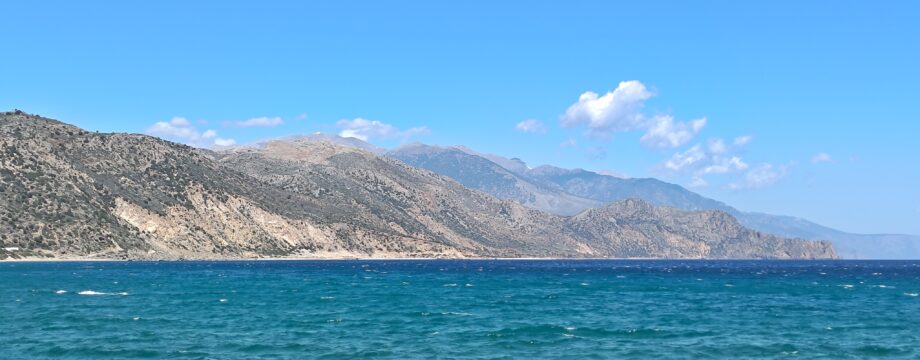
As walkers all know, Crete is gorgeous. He he… But, yes, Crete is probably the most complete walking holiday destination among the Greek Islands, it has all that any walker of any level could wish for. However, distances are big, and you will have to stay at various bigger towns or “tourist centers” to get around with the (good) public bus system, at least if you want to walk every single day.
The bigger towns and resorts displays mass tourism at its worst. They will provide a plethora of (more than) adequate accommodation (at a price), but quality of food and drink are very variable indeed. In fact, when it comes to food and drink, I have at least in the past had my worst experiences of all my years in Greece on Crete. This does not mean that everything is bad, I even have had some of my best experiences actually…
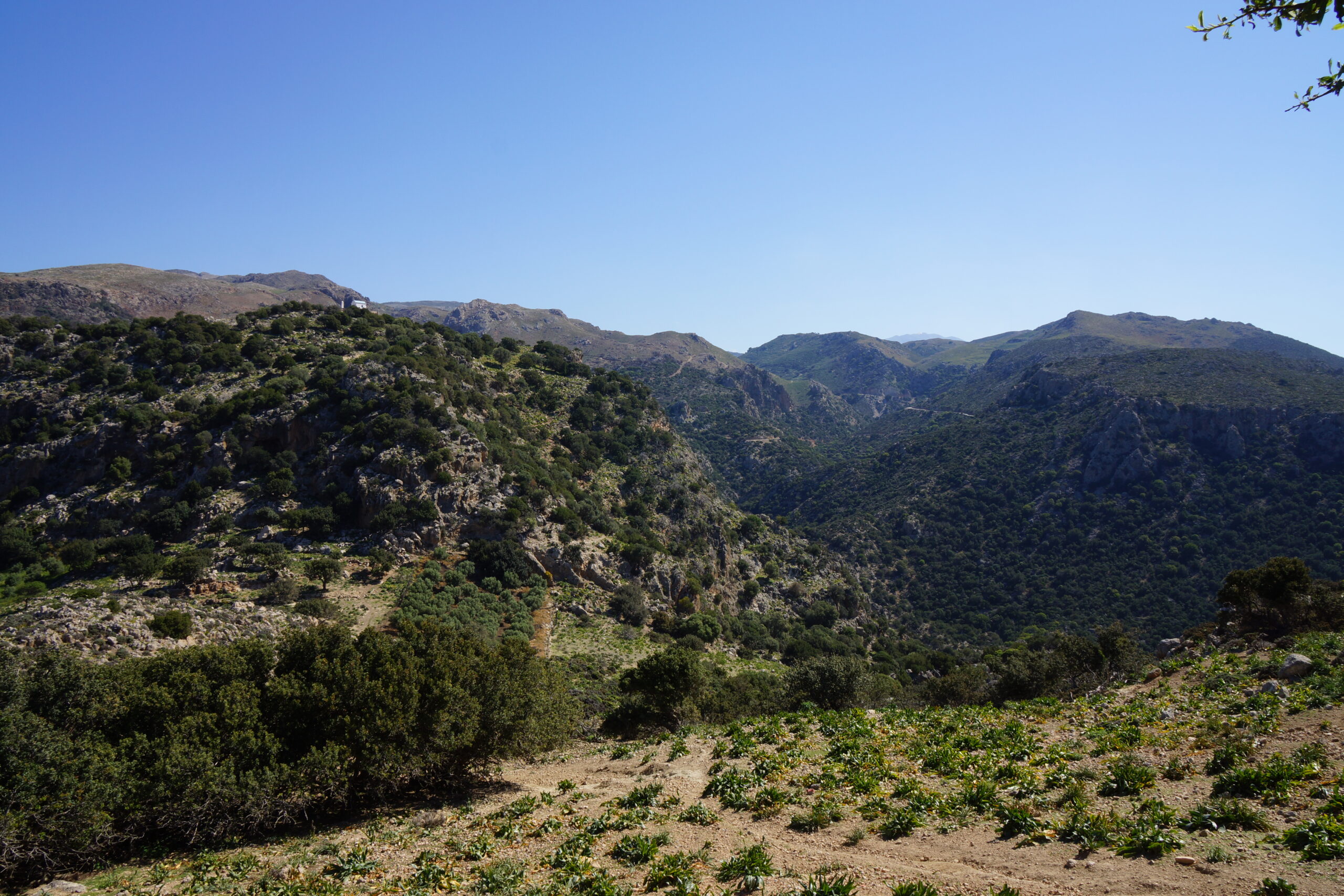
All this is something you will have to endure. Staying at better hotels will relieve some of the pain. And the reward is great. The mountains and e.g. the fertile landscapes of western Crete are extremely beautiful. The sheer greenness can only be compared to Corfu.
Good bases for walking, sightseeing and “intra-island hopping” will be (from east to west) Sitia (which I did not visit myself), Ag. Nikolaos, Iraklion, Rethymnon and Hania. Iraklion is perhaps not very interesting in itself, but should be visited for the obligatory sightseeing (Knossos, Archaeological Museum).
Selected walks: For walks on Crete take a look in “Landscapes of Western Crete” (W-marked walks below) and “Landscapes of Eastern Crete” (E-marked walks below), both by Godfrey and Karslake, as well as Marc Dubin’s “Trekking in Greece”. You should also check out “Crete – The White Mountains” by Loraine Wilson, “Western Crete – Walking in the Kissamos” by Alan Hall, as well as “Crete East” and “Crete West” by Gert Himer and Jakob Murböck. Lance Chilton has several booklets on Crete, see “Walks in Elounda, East Crete”, “Walks in Plakias, Southern Crete” and “Walks in Rethymnon and Georgioupolis, Crete”. A couple of newer efforts (2003) is “Circular Walks and Gorges in East Crete” (ISBN 960-87462-6-4) by Caris Gallos and Anne Bouras, and “Walks with Crete’s Wild Flowers” (ISBN 978-0954598808) by Jeff Collman. You should also check out Discover… on Foot, new walking guides to many areas of Crete.
For maps we have the Road Editions “Eastern Crete” and “Western Crete”, or even better the Anavasi “mapp”.
I have organized the walks in five sections, from Ag. Nik, from Hania, from Rethymnon, from Georgoupolis and from Paleochora. An alternative organization would be to separate the gorges into their own section. Because so many people visit Crete to walk some of the uncountable gorges, I have collected a list of a few of the most well known of these at the end, in alphabetic order, explaining how they can be reached etc.
Walks in the east (Walks accessible from Ag. Nikolaos): When I refer to walk numbers etc. from “Landscapes of Eastern Crete” by Godfrey and Karslake, this information is taken from the book’s 3rd edition.
UPDATE: There is now a 4th edition available, where I have any comments at all I have included notes after each walk for users of this edition. Beware that these notes are not quality-tested in any way, but are made from my assumptions.
UPDATE 2: We are now (2025) up to the 6th edition, but I have no plans to buy this book.
•E1 KRITSA GORGE (my total time 4h): This is walk 2 in Godfrey and Karslake. Easy to find and follow inside the gorge (where else can you go inside something this narrow), but some route-finding problems towards Tápes.
Finding the entrance to the gorge should not be a problem, it’s clearly visible from a distance, and Kritsa itself is only 20 mins by bus from Ag. Nik. Once you are down to the riverbed it should not be necessary to leave it until you leave the gorge entirely. Some tempting paths looks like easier going on the initial part, but then it will be more awkward back down to get through the first fence, as there is no other way to pass than the gate on the bottom. After the gate there it’s a bit of scrambling at a couple of points to pass big fallen boulders, as promised. This is a rather rough stretch, keep alert and carefully pick the best way through the mess. I cannot remember any more fencing or gates at this stage of the walk. Later, at the narrowest part of the gorge, you can touch both walls beside you as you walk! There is a fence or two on later stretches, all are passed by just STEPPING OVER them at marked spots (look for cairns).
The last fence, where you leave the riverbed, can also be faster and easier passed this way, instead of using the gate (the latch was stuck in some fashion). Then pick up the track on the other side. Later, be sure to spot the cairn marking the path taking you left from the track and into the olive grove. There are three paths forking off from the water trough. The one to the LEFT of the trough seems to be marked by a cairn and a blue paint blob, but I did not try it. The fork slightly to the RIGHT of the trough was not a good choice, it dissolves in the very steep orchard up the hillside. Later experiences showed that the RIGHTMOST fork would have been a good choice. The path (or any traces of paths you will use) will take you up to another track, where you turn right. Get off the track by the FIRST (remains of…) a house you encounter. A kind of garbage heap at this spot, you cannot actually see well from the track that the concrete “main street” of Tápes actually begins behind it. I stayed on the track too long here, making a long detour via the main road and then back left towards Tápes, then turned left into Tápes to finally get onto the concrete “main street” of the village, and continued down it to start my return.
Returning on the track used on they way up, turn right from the “main street” and look for blue paint blobs on your left (down) side to spot the steep footpath back down to the water trough, where you emerge at the rightmost fork.
The return path is rather obvious from the (stuck) gate, and for me the book just contained too many details. It is just to continue along the obvious main track in the rather obvious direction, and just where this track turns SHARP left, after a junction, be sure to spot the donkey path continuing STRAIGHT AHEAD towards Kritsa. It is also clearly marked by a cairn. Some of this path is rather overgrown and also steep at points, but it should not be possible to go wrong here. You will soon be safely back in Kritsa.
UPDATE: In the fourth edition the instructions from where you leave the riverbed seems to better match what I experienced. From the water trough my suspicions about the path to the LEFT seems to be correct. Good update this! I stick by my other comments.
•E2 ELOUNDA – PLAKA (my total time 3h): This is walk 6 in Godfrey and Karslake. For me there was no huge problems finding and following this walk throughout, but be careful to follow any waymarking cairns! I did not find all instructions clear at all times, and I was in doubt at several occasions. From Elounda, the 3rd edition of the book says go RIGHT at a fork either side a telephone pole, the 2nd edition (I later discovered) said go LEFT. The last edition seems to be wrong here, as I went right and had to turn left at a later T-junction to get back on track. What is more clear to me now is that there are TWO forks, and you go left at the first, right at the second.
After Kato Pines I could not get a clear match for the instructions in the book. Follow the main track in the rather obvious direction ahead and when it starts to veer too much to the left, a path winds its way up towards the main road. Carefully follow all cairns and you cannot go wrong.
Later, going down into the next valley, watch your step, the path is very steep, stony and narrow. From the track at the bottom, after you have curved right, be sure to spot the path forking off left, marked by a cairn. Now weave your way carefully up (mostly) on this overgrown path towards another track, where you turn right. Follow this track the whole way to the main road just before Plaka.
BEWARE: Some of the intermediate timings in the book are inconsistent. It will take about 2-3 times as long as the book says (10 mins!) to get from Havgas to the main road by the suggested route.
UPDATE: In the fourth edition the text is basically the same at the points where I had problems/comments.
•E3 MARDATO – KALO HORIO (my total time 4h22, the whole way to the beach): This is walk 3 in Godfrey and Karslake. Easy to find, but not always easy to follow (still you won’t get far off track, even if the instructions seemed confusing at some points, again be aware that the intermediate timings are inconsistent).
From Mardato, it will take at least 7-8 mins to reach the track (at their average pace). There are no problems in finding the route until you are closing in on Kroustas, but do look out for waymarks. A couple of minutes before the last bend towards Kroustas there is a (probably new) T-junction. The right fork goes past a radio mast or something, you go LEFT.
Leaving Kroustas I found I could NOT keep “hard right”, instead continuing STRAIGHT AHEAD down a path where the street itself turned sharp left just before a small church. This path will later encounter a track, follow that. It might be possible to stitch together remains of the old path further still, but I did not investigate. It is probably very overgrown.
The path leaving down right into the small gorge is clearly marked, and surprisingly good underfoot, however it is steep. Passing the brow on the hill on the other side continue to follow the blue waymarking at all points, DISREGARDING ANY RED ARROWS you might encounter. Not far down from the brow there IS a fork left with faint red arrows seemingly luring you in that direction. However, this is NOT the right way, you fork RIGHT, following the blue paint blobs. There are no other forks towards Agios Nikolaos.
After entering the road by the church, and after passing the smallholding and the river bed, there is much more than 15+5+2 mins to the “ugly concrete building”, it should be at least 30 mins total (their average pace). And “ugly concrete building” is also ambiguous. You are actually not supposed to cross the river bed again until the point where the road turns concrete. To do this you will have to just stay on the road for the whole stretch, ignoring any forks left or right!
UPDATE: In the fourth edition the text still basically the same at many points where I had problems/comments. However, references to the missing fork towards Agios Nikolaos are gone. The commented timings 15+5+2 are now 15+10+2, which better matches my experience at this point, and the building is now “grey and yellow”, which is a far better description!
Walks in the west – part 1 (Walks accessible from Hania): When I refer to walk numbers etc. from “Landscapes of Western Crete” by Godfrey and Karslake, this information is taken from the book’s 3rd edition.
UPDATE: There is now a 4th edition available, where I have any comments at all I have included notes after each walk for users of this edition. Beware that these notes are not quality-tested in any way, but are made from my assumptions.
UPDATE 2: There is now even a 6th edition. I have not seen it (or the previous one), so I do not know the present relevance of my notes below.
UPDATE 3: We are now (2025) up to the 10th edition, but I have no plans to buy this book.
UPDATE 4: Any further walks for me in this area will be done using the “Discover Chania… On Foot” by Berend Wolffenbuttel & Toine van der Meijden.
•W1 CIRCUIT VIA AGIA (my total time 3h08): This is walk 1 in Godfrey and Karslake. Small warm-up exercise best done in trainers. Mostly under asphalt now, but you should still be able to find your way using the book as your over-all guide and following the road signs. There is hardly any traffic, and the beautiful fertile valley with its lake should really not be missed.
Mind that the map tracing of the new motorway is slightly off, you will pass under it about 50m after the fork. At the fork of the route take the LEFT option, then turn sharp right after the underpass to get back on track. At Kirtomados after the “large old house with arched wooden door”, you turn left on the road almost IMMEDIATELY, not in “5 mins”. The track to the lake has a BIG SIGN.
Beware that your return route to Stalos might be blocked/hindered by more road building/enhancement and that all waymarks may be obliterated. At least I could not spot the ascent back up to this village, EXCEPT for the point where machines were in heavy action, at the point where asphalt was again met. Instead of turning left here and risk being laid under asphalt, I just continued straight ahead. Continuing on this road, later track, as straight as possible, finally took me down through olive groves into the next valley to the east (loose dogs might be encountered as you pass a small farm). There a road and another underpass took me right back to the starting point at Kato Stalos. Mind that the Shell station at Kato Stalos is gone.
UPDATE: In the fourth edition the map tracing for the motorway is correct, so this problem has disappeared. The previous reference to the now missing Shell station at the start of the walk is also rewritten. At Kirtomados the previous “5 mins” referred to above have been corrected to “less than a minute”. Yes, it seems they’ve got it all!
•W2 AGIA IRINI GORGE (my total time 3h10): This is walk 16 in Godfrey and Karslake. An excellent and beautiful gorge, easy to walk throughout, but steep at points. All safety railings were in place, which is a great plus! Very peaceful, not many walkers out. A lot of work has gone into making this walk possible, but still not commercialized. Not even in the ways of public transport, as it is only accessible from Hania on one bus early Sunday morning (Medio June). Easy to find and follow, finally a walk that does not need a lot of explanation. Just enjoy!
•W3 XILOSKALA – LINOSELI COL – XILOSKALA – KALLERGI – XILOSKALA (my total time 4h10, first walk total 2h10, second walk total 2h, net walking time to the Linoseli Col 1h45): This is walk is a combination of 19 (SW) and 20 (SW) in Godfrey and Karslake. Both “short walks” from Xiloskala which is easy to find and follow, but the going is very tough, at worst. If you are a fairly fast walker, and you go on the first (very early) morning bus from Hania, you should have no problems getting through the whole walk until the only return bus (early afternoon).
The ascent of the Linoseli Col is not for the fainthearted, and really SHOULD NOT BE ATTEMPTED ON YOUR OWN, as there will be few other walkers around to help if anything goes wrong. MOUNTAIN BOOTS WITH GOOD GRIP ONLY! A walking stick is also recommended. At my visit some seemingly recent landslides had more or less obliterated the path at a couple of points, making progress very slow.
On the other hand, the ascent of Kallergi is very easy, mainly on a gravel track. It should not be missed because of the extensive views in every direction at the top. You will also discover what the letters PC really stands for (PLUMMS CLOSET, and this one must have the world PLUMMS record as well).
•W4 IMBROS GORGE (my total time 2h59): This is walk 25 in Godfrey and Karslake. Another very beautiful gorge that is so narrow that you can touch both sides as you walk. As it is also skewed in all directions you will be totally surrounded by rock, like in a cave! Unfortunately this gorge is also starting to be commercialized, and there is an entrance fee (for now, just 500 GDR). Very easy to find and follow. The riverbed is stony, but not too bad underfoot. The bus from Hania to Imbros took (for once) a lot less time than expected, because of extensive enhancements of the Sfakia road. Almost all of the road towards Hora Sfakion was finished in a new and glorious state. The track towards the gorge entrance is clearly signed, just a few meters after the bus stop in Imbros. Have fun!
Where the gorge ends, by a snack bar, continue further along the riverbed until signs for tavernas and bus stop appears. Fork twice right for the shortest walking distance towards Hora Sfakion, when you meet the road again turn right.
UPDATE: In the fourth edition the text has not changed much, so exactly what to do when the gorge ends is still a little bit unclear here. Also, the text does not mention this possibility, but the new map suggests an alternative E4 marked path towards Hora Sfakion. Must be far more interesting than the road!
Walks in the west – part 2 (Walks accessible from Rethymnon): When I refer to walk numbers etc. from “Landscapes of Western Crete” by Godfrey and Karslake, this information is taken from the book’s 3rd edition.
UPDATE: There is now a 4th edition available, where I have any comments at all I have included notes after each walk for users of this edition. Beware that these notes are not quality-tested in any way, but are made from my assumptions.
UPDATE 2: There is now even a 6th edition. I have not seen it (or the previous one), so I do not know the present relevance of my notes below.
UPDATE 3: We are now (2025) up to the 10th edition, but I have no plans to buy this book.
UPDATE 4: Any further walks for me in this area will be done using the “Discover Rethymnon… On Foot” by Berend Wolffenbuttel & Toine van der Meijden.
•W5 PRASSANOS GORGE (my total time to the center of Retymno about 4h30, net walking time for the gorge itself 3h20): This is walk 7 in Godfrey and Karslake. This awesome gorge close to Rethymnon is certainly not for tourists. Easy to find (but be careful to get off the bus at the correct spot), and not difficult to follow, although the going is rough at points. Because of the rather awkward clambering, and that few (if any) other walkers will be around to assist if you should have an accident, this walk really SHOULD NOT BE ATTEMPTED ON YOUR OWN. The entrance to the gorge will be easy to find, it’s more than visible from a distance… There is however NO SIGN from the road. Beware of noisy dogs on the loose as you pass a small farm. At all points the instructions in the text proved sufficient, the diversions from today’s situation were few and unimportant. Again be aware that the intermediate timings given in the text where inconsistent, at least to me. The only crucial point is where you will have to leave the riverbed for a while to pass heaps of big fallen boulders. Here cairns will show you where to go, you must carefully follow these waymarks through a massive scree area. Keep the waymarking on your left (lower) side to avoid starting your descent back down too early. When the scree area is left behind, a small path continues on. Take this path until cairns again lead you scrambling down to the riverbed. A few semi-rough spots are still ahead, but the mess will gradually clear up, if ever so slow.
Giant birds (vultures???) will probably be seen hovering high above you…
At Perivola, there is really no need to stop. There are plenty of useful tavernas ahead, and you are only slightly more than half an hour from the outskirts of Rethymnon (less than an hour to the center). Heavy traffic though, but there is an alternative route by the sea for most of the way.
UPDATE: In the fourth edition the text has not changed much, and there is not much reason it should have, however the intermediate timings are not updated, I could not get these to match very well at my visit.
Walks in the west – part 3 (Walks accessible from Georgioupolis): When I refer to walk numbers etc. from “Landscapes of Western Crete” by Godfrey and Karslake, this information is taken from the book’s 4th edition. Also Check out “Discover Georgioupolis… On Foot” by Berend Wolffenbuttel & Toine van der Meijden.
UPDATE: We are now up to the 10th edition of “Landscapes of Western Crete” but I will probably not buy this update as I plan to mostly rely on “Discover Georgioupolis… On Foot” from now on.
•W6 GEORGIOPOULI CIRCUIT (my total time 3h45): This is walk 5 in Godfrey and Karslake. A great walk with good views. Easy to find and mostly easy to follow. Parts of it are on road, but traffic was minimal. The book seem to match the situation at my visit very well.
Walks in the west – part 4 (Walks accessible from Paleochora): When I refer to walk numbers etc. from “Landscapes of Western Crete” by Godfrey and Karslake, this information is taken from the book’s 4th edition. Also Check out “Discover Paleochora & Sougia… On Foot” by Berend Wolffenbuttel & Toine van der Meijden.
UPDATE: We are now up to the 10th edition of “Landscapes of Western Crete” but I will probably not buy this update as I plan to mostly rely on “Discover Paleochora & Sougia… On Foot” here.
•W7 PAPPOURA CIRCUIT (my total time 3h20): This is walk 1 in “Discover Paleochora & Sougia… on Foot” by Wolffenbuttel and van der Meijden using the mentioned “Possible shortcut”. Mostly a nice walk but especially one part of the return felt more like mountaineering than actual walking. Mountain boots with good grip only!
•W8 MOUNT VIGLES (my total time 2h20): This is walk 2 in “Discover Paleochora & Sougia… on Foot” by Wolffenbuttel and van der Meijden using their return route both ways and skipping the first mountain. I do not think their ascent is suitable for elderly people 😉
•W9 E4 FROM PALEOCHORA TO GIALISKARI BEACH (my total time 2h30 return, this includes a beer at the beach café): This is a small part of walk 17 in “Landscapes of Western Crete” by Godfrey and Karslake. Mostly an ugly dirt road, so nothing spectacular. The beach café however was very nice.
Gorges: References are either explicit or to the numbered walks above.
• Agia Irini: See W2 above. Walk 16 in Godfrey and Karslake (West). Best accessed by bus from Hania.
• Anidri: Optional part of Walk 1 in “Discover Paleochora & Sougia… on Foot” by Berend Wolffenbuttel & Toine van der Meijden. Access from Paleochora.
• Aradhena: Walk 23 in Godfrey and Karslake (West), “Loop via Livaniana & the Lower Aradhena Gorge” in Dubin. Total transport time from Hania 2h30 (bus + ferry). Same on return.
• Faragi Nekron: Walk 12 in Godfrey and Karslake (East). Best accessed by bus from Sitia.
• Ha: See Godfrey and Karslake (East). Best accessed by bus from Ag. Nik. or Sitia.
• Imbros: See W4 above. Walk 25 in Godfrey and Karslake (West). Best accessed by bus from Hania.
• Kritsa: See E1 above. Walk 2 in Godfrey and Karslake (East). Best accessed by bus from Ag. Nik.
• Pefki: Walk 13 in Godfrey and Karslake (West). Best accessed by bus from Sitia.
• Polamos: Miniature gorge at Sougia, see Walk 17 in Godfrey and Karslake (West).
• Prassanos: See W5 above. Walk 7 in Godfrey and Karslake (West). Best accessed by bus from Rethymnon.
• Samaria: The largest and most well known of all Crete’s about 2000 gorges. A great experience no doubt, but will probably not be visited by myself. I prefer not to walk with hordes of others, and also not to do the same as “everybody”. The fragile nature around the gorge is also showing signs of fatigue, which is another point why I don’t want to promote this place as the primary walking destination in all of Crete. Follow the instructions found in any of the mentioned books (Walk 12 in Godfrey and Karslake (West), Walk 21 in Godfrey and Karslake (East), “ASCENT OF THE SAMARIA GORGE” in Dubin).
• Good starting points: • Hania – from here buses will take you to most of the western part of the island • Rethymnon – some walks in the west are closer to this place • Ag. Nikolaos – from here buses will take you to most of the eastern part of the island (for schedules, see “More Info” below) • Sitia – some walks in the east are closer to this place • Iraklion – the most common entrance point to the island, long distance buses (or taxis) will take you to the two main walking destinations, it also offers good museums and archeological sites, which will provide some form of walking as well…
• How to get there: • By air to Iraklion or Hania • By ferry to Iraklion from the Cyclades or the Dodecanese
• More info: • Interkriti: The WEB site of Crete – also contains some information about mountaineering/skiing/walking clubs and other outdoor activity • Holidays in Crete!!! by Crete TOURnet • Regular Bus Service on Crete by K.T.E.L. Hania – Rethymnon S.A. has bus timetables for the island • Discover… on Foot – walking guides to many areas of Crete
This page was last modified at July 9, 2026.
©2000-2026