Κέα (Τζιά) – Cyclades
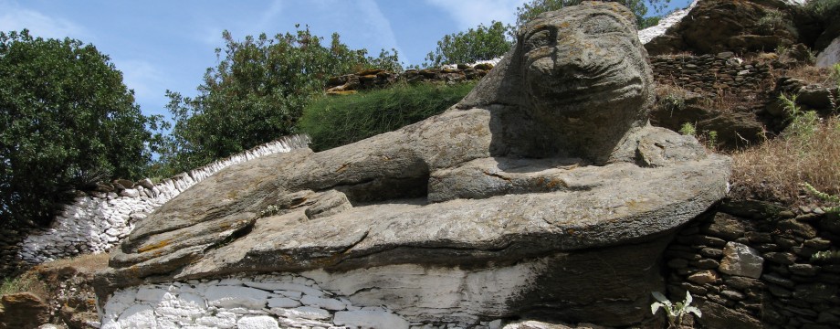
Kea is an island that is not affected by tourism in any large scale. Instead it is covered by holiday homes of the wealthy Greek. Many people know nothing about this island except that they will have heard of its famous lion (luckily this one is of the friendly kind).
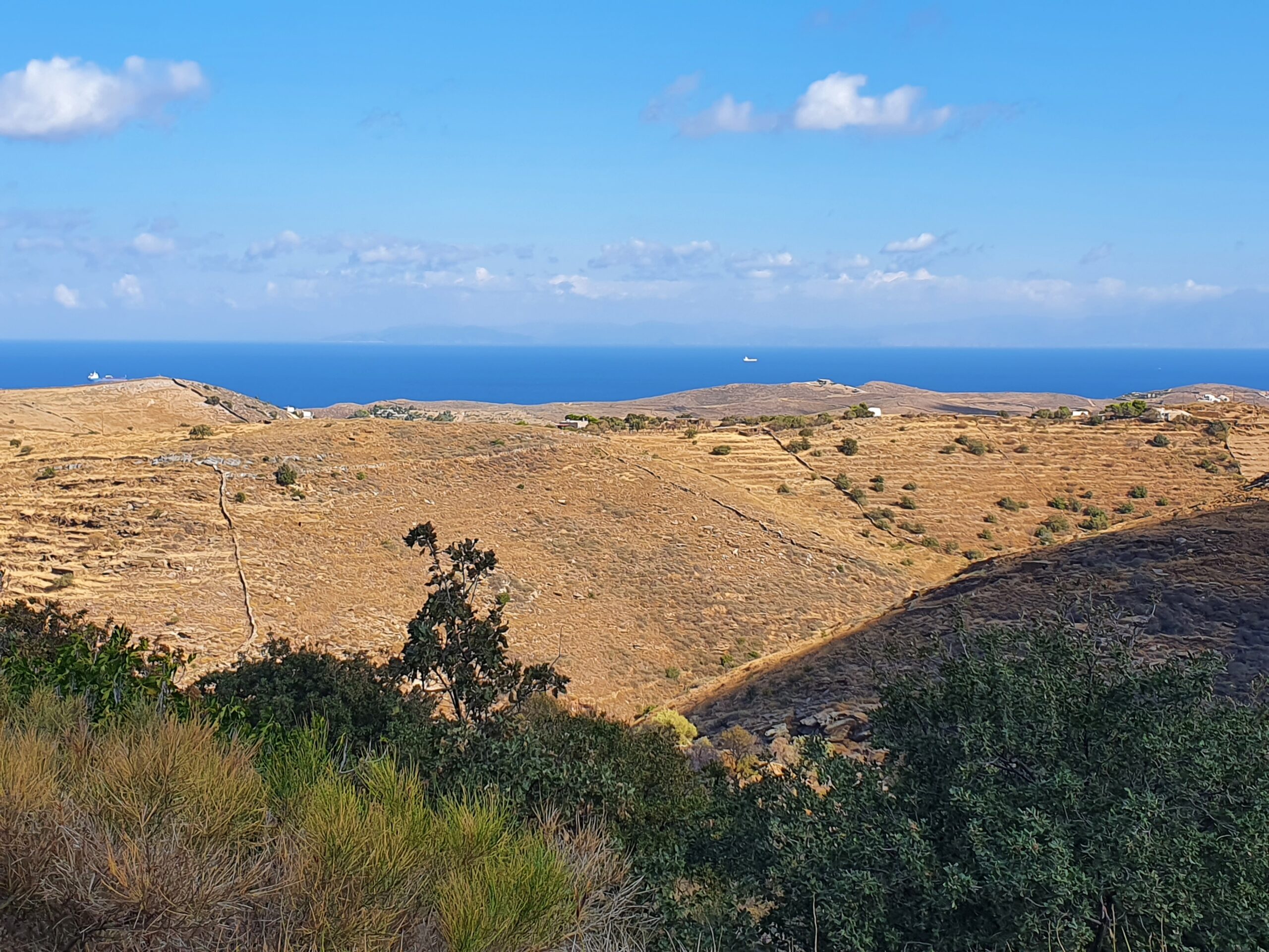
The island is relatively green for a cycladic island, and you can do many beautiful walks. Also unusually, it has several “official” walks which are both signposted and marked. Unfortunately the rudimentary bus service makes these walks less accessible than they could have been.
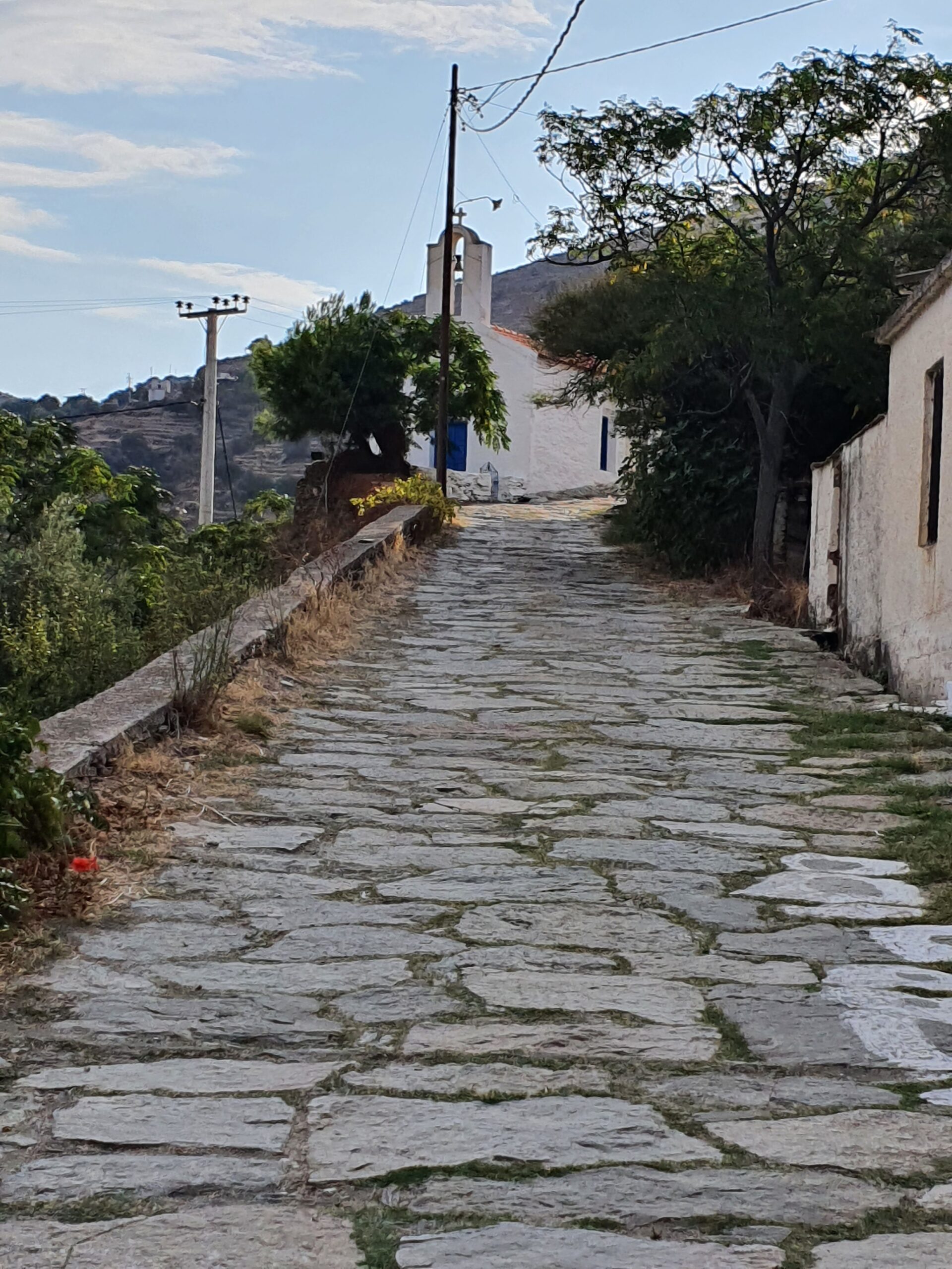
The fairly peaceful port village and the beautiful hill Chóra are both well worth a visit.
Selected walks: For possible walks on this island see Walking, hiking and trekking on KEA by Raymond Verdoolaege. Good Anavasi (1:25000) and Road Editions (1:40000) maps exist. Also check out “Santorini, Sifnos and the Western & Southern Cyclades” by Dieter Graf (referred to below as “/Graf/”).
•1 KORISSÍA – IOULÍDA (1:04; 6353 steps; 5.1km; alt. gain 260m; alt. loss 17m): Stroll up the river bed to Milopótamos, then take the kalderími from there. This (still nice) transport stretch will no doubt be walked many times on a visit to this island…
•2 IOULÍDA – “LEÓN” – VOURKÁRI (2:20; 10961 steps; 8.8km; alt. gain 151m; alt. loss 451m): This is walk 32 in /Graf/ using the alternative of going straight to Vourkári, where you will find pleasant tavernas. It is also official walk 1 on the island. If you are here just for the lion an idyllic stroll from the Chóra and back will do the trick. Signed and impossible to miss. For general directions you can e.g refer to the Chóra map you find in “Greek Island Hopping” by Frewin Poffley. But the preferred walk, instead of returning back to Chóra, follow /Graf/ and continue all the way to Korissía (i.e you end up at Vourkári where you can just stroll to the port, after the obligatory taverna visit).
•3 IOULÍDA – KORISSÍA (2:08; 9641 steps; 7.7km; alt. gain 148m; alt. loss 400m): This is an attempt at walk 31 in /Graf/, but skipping the Fléa part that I kept for another day (see walk 4 below). Initially the walk is very nice, but after crossing the road it soon turned out it was impossible to continue. The path was both overgrown and filled with debris, obviously not used for decades. Instead use e.g the Topo map to find the old monastery close by and continue from there. This route actually skips ALL road walking, you just pass straight over it to find the access road. From the monastery it looked easiest to descend on terraces until it was ok to cross over the valley to pick up a walled footpath from there. You should be able to see an opening in the wall. Note that this path is also badly maintained and pretty rough, but still passable. This way you can get yourself fairly safely down to Ag. Konstantinos. However I cannot after all recommend this walk. Exhausted when I finally reached Milopótamos, instead of following the sign towards the water mills (see above) I just cut straight back to Korissía.
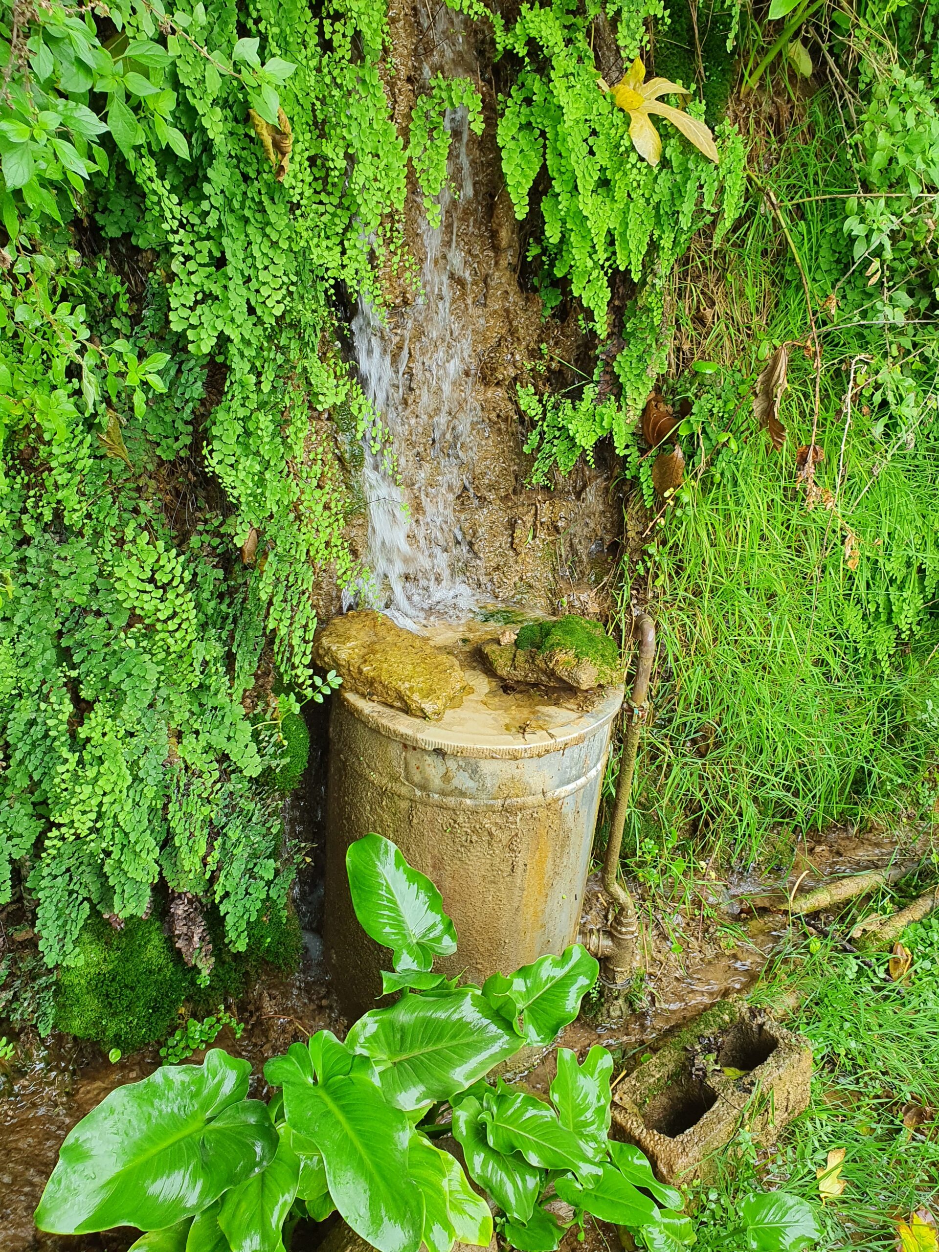
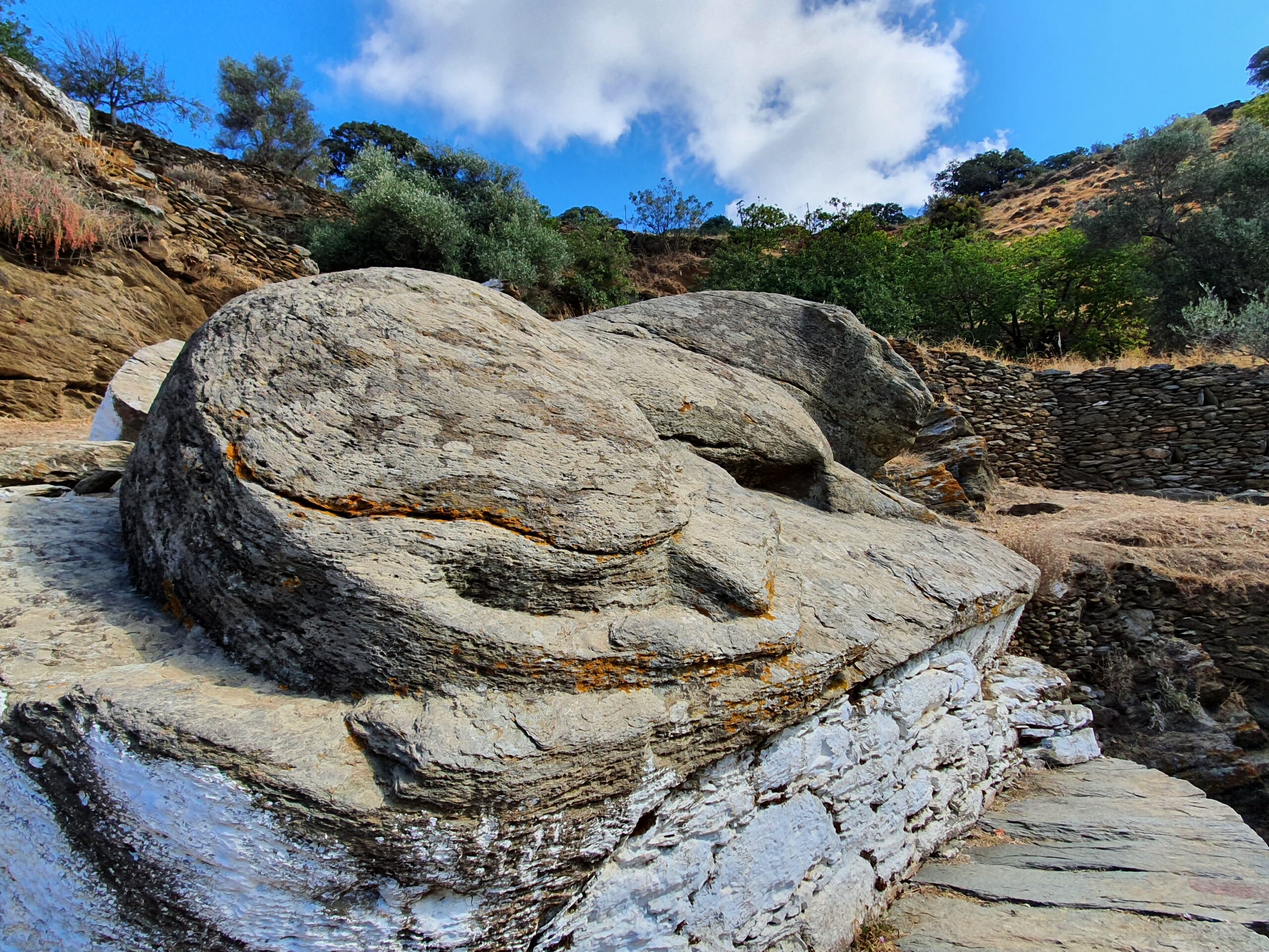
•4 KORISSÍA – MILOPÓTAMOS – FLÉA – STAVRÓS – KORISSÍA (1:54; 10112 steps; 8.1km; alt. gain 242m; alt. loss 245m): Here we do the final parts of walk 31 in /Graf/ (see walk 3 above), making it a nice round trip from Korissía. An easy walk, just take care to find the marked continuation at all times. Navigation in the valley can be semi-confusing at points. Be sure to pass to the RIGHT of a house you suddenly encounter (with a dog sign, scary…), then immediately curving upwards to the left to find the valve (see picture above). The rest of the walk is very easy, following various roads.
•5 KORISSÍA – IOULÍDA (via KÓMI) (2:42; 12314 steps; 9.9km; alt. gain 547m; alt. loss 252m): This is an attempt at following the official walk 2 on the island all the way up to the Chóra. Use e.g the Topo map to find your way. As it turned out the marks and signs were not enough… On the road just after Ag. Konstantinos walk 2 goes steeply down into the valley. Very steeply. This path is not maintained and is actually a bit dangerous. I do not understand why this is still an official walk in this condition. A stretch is even mostly obliterated by road building and you will have to do a balance act on rather unsteady rocks. Up the valley from Kómi on the other side is also rough. Then you encounter a road with a number 2 sign, and no obvious continuation except for that very road. Right? Wrong. No more signs for this walk were ever found, and I continued on roads until I eventually picked up official walk 1 and could retrace my steps from my walk 2 above (i.e in reverse) to finally get myself to the Chóra. A very long detour… I wrapped up the “lost” parts in my walk 6 below.
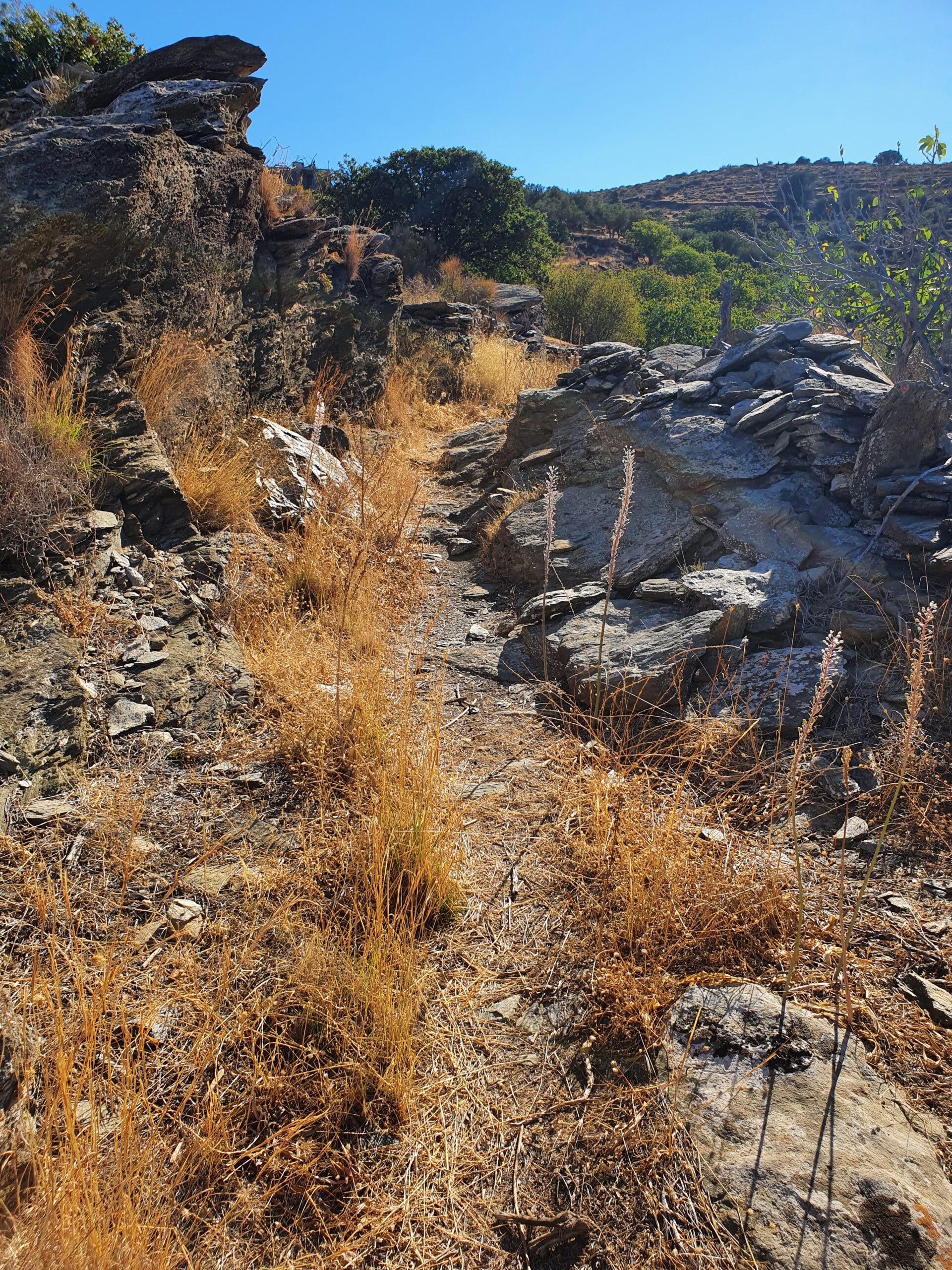
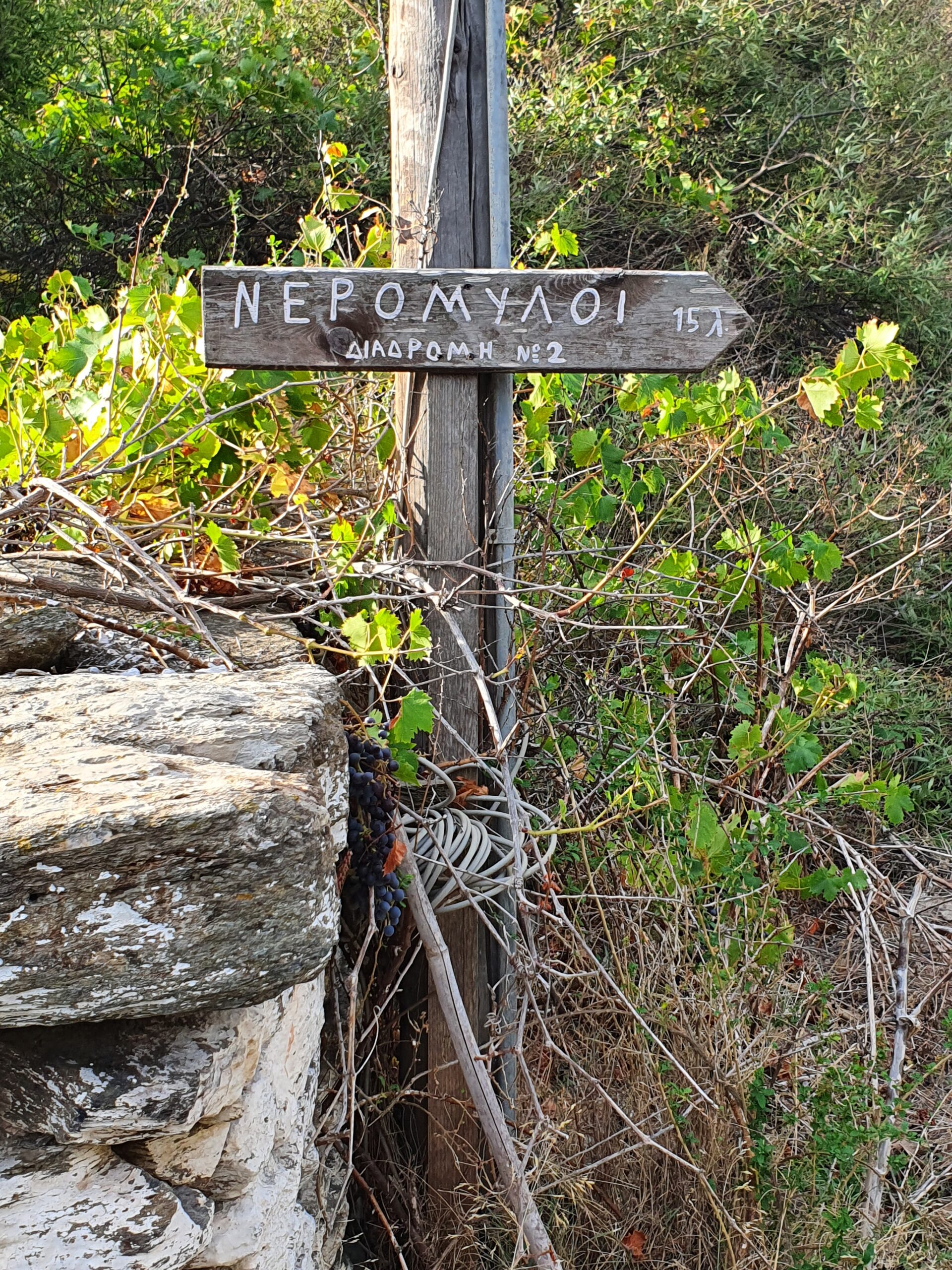
•6 KORISSÍA – IOULÍDA (via GIALISKÁRI and FOTIMÁRI) (2:19; 9785 steps; 7.8km; alt. gain 577m; alt. loss 321m): This follows the remaining parts of official walk 2 on the island (the parts not covered by my walk 5 above). The initial parts of the walk strolls some back roads to get back to the crucial point above Kómi. Use e.g the Topo map to find your way. So you are not supposed the enter that road above Kómi after all even though it is marked with a number 2 sign. Instead you must hunt out the hidden continuation (see picture above) behind some cliffs and walls OR even continue right on a completely overgrown section just before hitting the road.
•7 CIRCUIT ABOVE IOULÍDA (3:14; 14984 steps; 12.0km; alt. gain 584m; alt. loss 594m): This is walk 34 in /Graf/, an absolutely wonderful walk that comes with my warmest recommendations. However, there are lots of instructions in the book, most of which seems completely unnecessary or even confusing, as many details can never actually be seen. But it should take little effort to find your way, the route ahead is mostly obvious.
• Good starting points: • Korissía – the port village • Ioulída – the Chóra
• How to get there: • By the odd ferry from some islands in the Cyclades North • By ferry from some other islands in the Cyclades West, most notably Kythnos • By the odd ferry from some islands in the Cyclades Central • By ferry from the mainland at Lavrio, usually two departures daily
• More info: • Walking, hiking and trekking on KEA by Raymond Verdoolaege • PATHWAYS – KEA by Destination Kea
This page was last modified at February 19, 2026.
©2007-2026 .