FUERTEVENTURA – Canary Islands
Fuerteventura is probably the one of the Canary Islands with the most sand per tourist… Excellent for a relaxed beach holiday with some good eating. It even has several good walks.
But if you don’t come for the walks, and even if the beaches don’t tempt you much, DO come here for all the great food!
Good places to eat in Morro Jable and surroundings on my first visit to the island: “La Chosa” and “El Rancho”, among many others… They of course had good fish restaurants as well, e.g “Confradía de Pescadores” by the small fish harbour.
In Corralejo the Chinese restaurants were very interesting. Here you could find specialties like Shark Fin Soup and Pekin Duck! These restaurants were also more relaxed than the Spanish places in central Corralejo, which were just packed with tourists and I had to be very early to get a decent table there. The most interesting Spanish food outlets were by the harbour/beach promenade, which were less frequented by the tourist crowds. E.g. Cordon Blue, which were very simple, but also very hospitable.
In El Cotillo food was also great. If I have to pick a couple of favorites it will have to be “Olivo Corso” and “Pez Gordo”. The village itself is also absolutely delightful.
Selected walks: For walks on Fuerteventura take a look at Noel Rochford’s “Landscapes of Fuerteventura” (referred to below as “/Rochford/”). I used the original 1st edition of the guide book on my visits in the 90s! They are now up to the 8th edition, which is greatly expanded from my version. The walk numbers I refer to are from the 7th edition, as it was bought for a trip that got postponed. I do not think there are any significant differences for the walks I have done as they all follow well known marked trails or even roads. I have also used “Fuerteventura Tour & Trail Super Durable Map” by David and Ros Brawn (referred to as “/Brawn/”). OBS: There is now a new edition of this map (by Jan Kostura). There is also “Walking in the Canaries Volume 2” by Paddy Dillon.
Walks from Morro Jable:
•1 MORRO JABLE – PICO DE LA ZARZA (my total time 3h30 return): This is walk 26 in /Rochford/. A good walk up to 807 meters, where the winds may be dreadful but where the views are excellent. Careful about that edge though, especially with a gale in your back… It is several hundred meters STRAIGHT down. Except for the very last part the walk follows a clear track.
OBS: I DID THIS WALK LAST IN 1997!
•2 MORRO JABLE – GRAND VALLE (my total time 3h00 return): This is a variation of walk 27 in /Rochford/. Take the dirt road south from Morro Jable, then head up the Grand Valle after about 4 kilometers. Be sure to spot the indigenous Jandia Thistle on the way. When you are on the top of the pass, take a rest and return back the same way. Continuing down on the other side, to Cofete, did not look very safe to me. Maybe the path is better maintained today.
OBS: I DID THIS WALK LAST IN 1997!
•3 MORRO JABLE – COSTA CALMA (my total time 3h00 ONE WAY, swimming not included): This is walk 28 in /Rochford/. Here you have several options. You can walk the whole stretch (or as much of it as you like) and return the same way, or you can take the bus back from Costa Calma to Morro Jable. My timing started by my hotel quite a bit south of were the walk starts in /Rochford/.
OBS: I DID THIS WALK LAST IN 1997!
•4 LOBOS (my total time 2h30, including a picnic at the firehouse and climbing the volcano): This is walk 1 in /Rochford/, an excellent easy walk. Take one of the morning boats out (around 10:00) and be picked up again at around 16:00. After doing the whole round trip you can have the rest of the day off at the quiet, idyllic beach.
OBS: I DID THIS WALK LAST IN 1998!
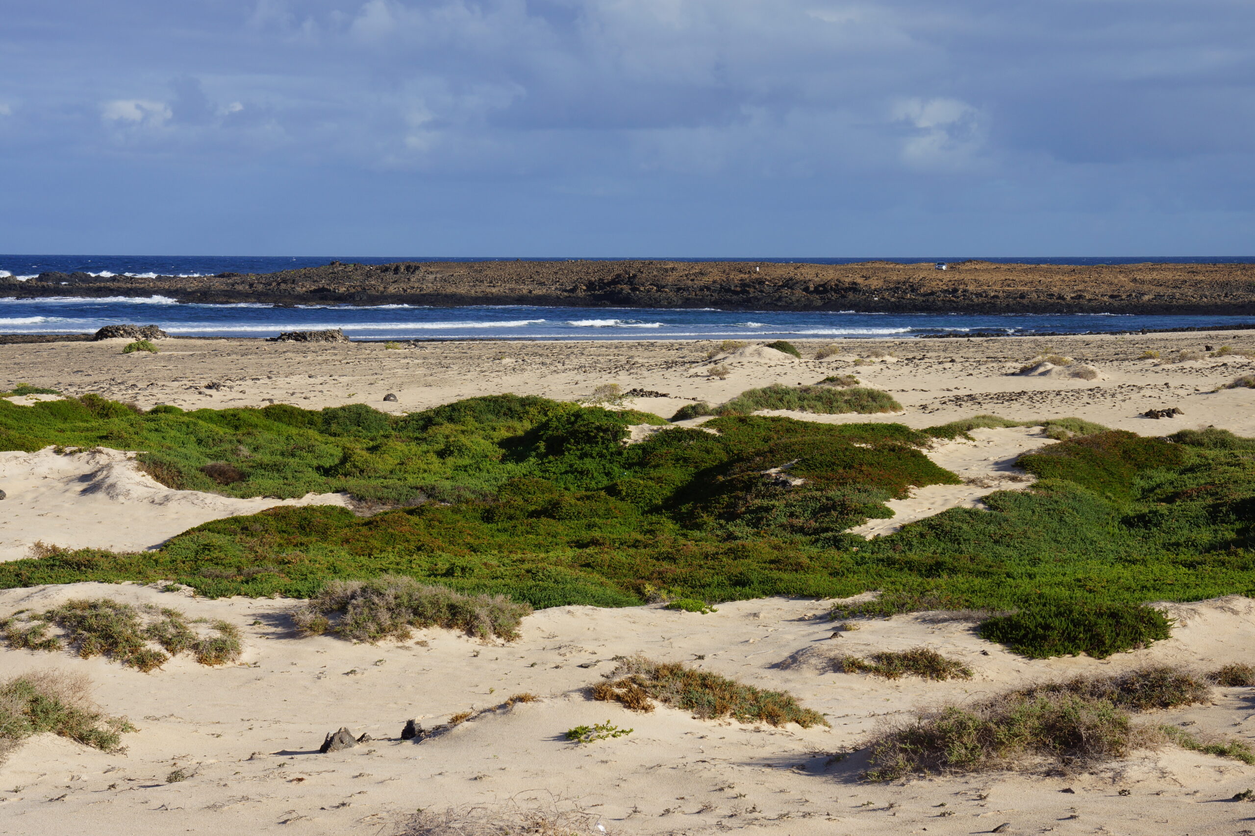
•5 CORRALEJO – EL COTILLO (my total time 5h00 return to/from the surf point at Playa el Hierro): This is (parts of, at least) walk 2 in /Rochford/. You can do the whole stretch, returning by bus, or as much of it as you care and then walk back where you came from. The jeep dirt road towards El Cotillo starts from the extreme north west point of Corralejo. I do not think there is any useful swimming along the way, not before close to the lighthouse at the other side of the island, but you can watch and admire some REAL waves break, and that is not so bad either. Just be warned that you will have to bite a lot of dust from passing vehicles. And some car drivers obviously had not read the fine print in their car rental contracts… I had the pleasure of seeing one of these being towed away (it was a matter of time, really!). But it is possible to shortcut the road at some points, as the landscape is mostly flat (but also very rough). See also my walk 8 below.
OBS: I DID THIS WALK LAST IN 1998!
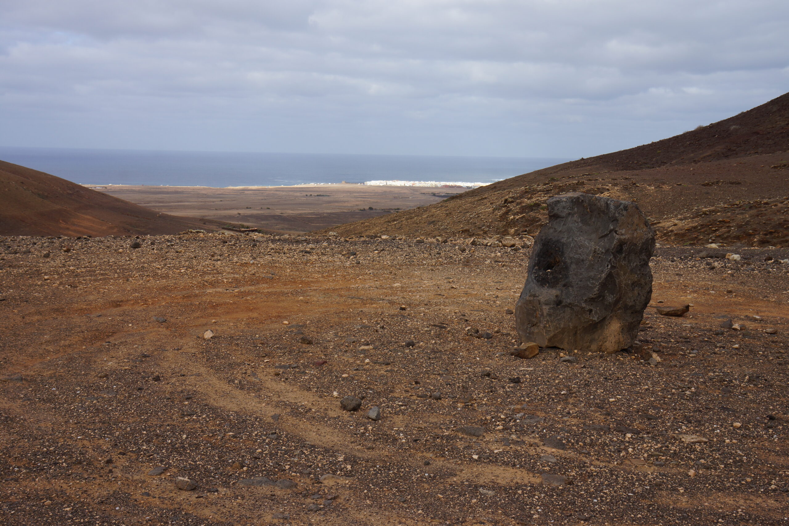
•6 CORRALEJO – LAJARES (my total time 3h00 return to/from Montana Colorada): This is (parts of, at least) walk 3 in /Rochford/, but starting in Corralejo. This excellent walk follows a very rough jeep road from Corralejo in direction of Lajares for most of the time. To get started, it is best to find one of the faint tracks/trails that leads from Corralejo straight in the direction of the San Rafael crater (or a little to the right of it). This area is heavily affected by road building, but you should be able to find something like a track, or you can just cross the malpais as best as you can. Head for the white concrete building with the large freshwater symbol painted on it, you can clearly see the jeep road to the left of that building. Just after the sign telling you that you have no access to the area around the building the road also forks. Take the fork to the right and follow this road from volcano to volcano. You can use this road all the way to Lajares or you can take a right fork in the directions of Montana Colorada on a footpath whose entrance is marked by some giant rocks. Another fork to the right, just a few minutes later, will allow a peak down in one of the volcanic cones, otherwise continue straight ahead for Montana Colorada. Just under this mountain, the footpath ends, and it’s what looked like a nice road from that point.
OBS: I DID THIS WALK LAST IN 1998!
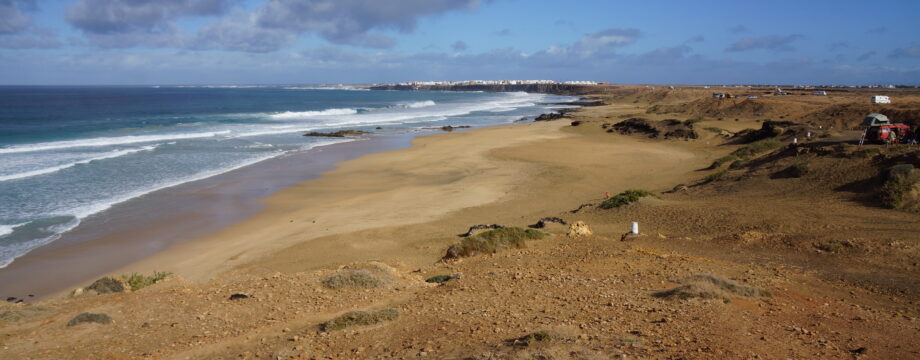
•7 LAS DUNAS (my total time 4h00 return, add your time for swimming and sunbathing): Everyone visiting Corralejo will of course do some of this stretch, to get an impression of how much sand there really is here. Giant dunes can be admired! If you walk the “beach promenade” all the way from the central Corralejo it will take more than two hours to get to the end of it. Do as much of it as you like.
OBS: I DID THIS WALK LAST IN 1998!
Walks from El Cotillo:
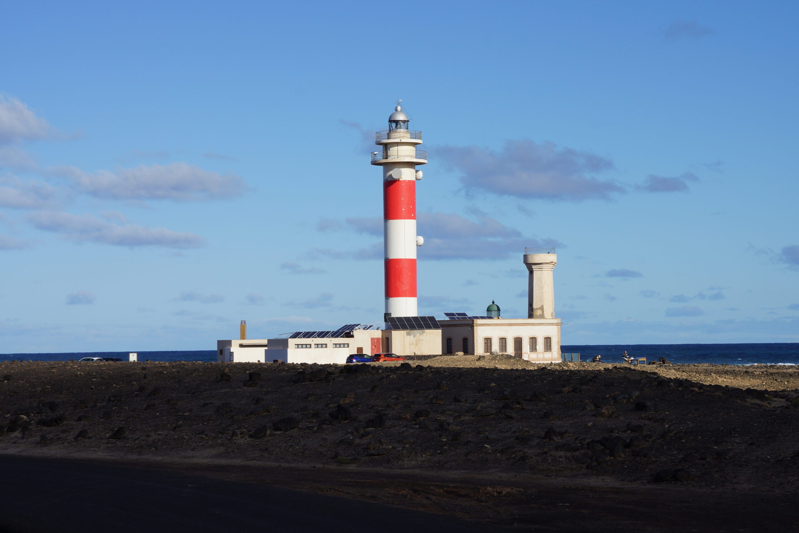
•8 EL COTILLO – FARO DE TOSTÓN (my total time 1h50 return): This is the last part of walk 2 in /Rochford/, but initially in reverse. It is very long but you can walk all the way to Corallejo and take the bus back. See also my walk 5 above. Today the bus connections are much better than when I first visited Corralejo, in the late nineties. See “More info” below for bus timetables. See /Brawn/ for essential short-cuts so you do not have to walk much along the main road.
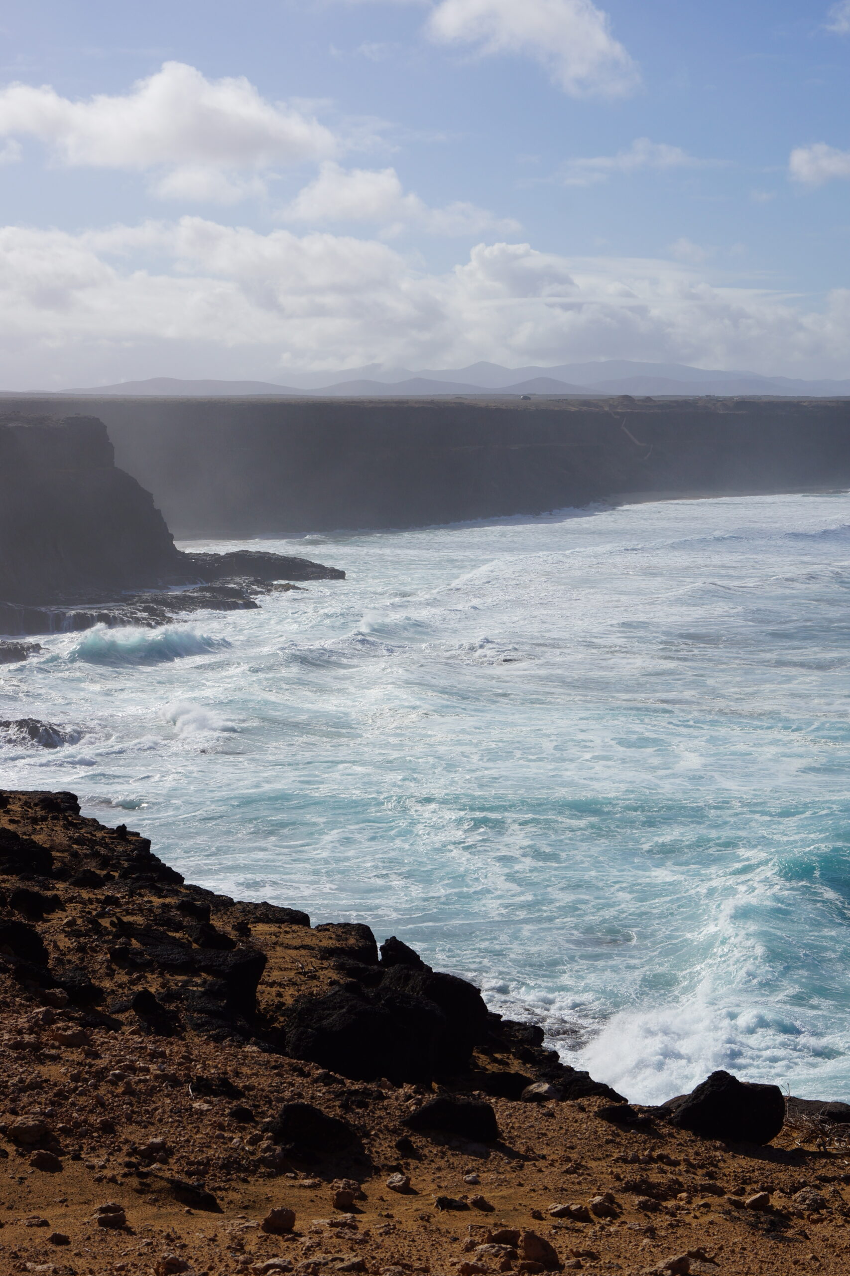
•9 EL COTILLO – PLAYA DEL AGUILA (my total time 1h55 return): This is part of walk 5 in /Rochford/. I walked only as far as a good lookout over to this rather insane beach, below huge cliffs, and then turned back. The route is obvious.
•10 EL COTILLO – LAJARES (my total time 2h25 return): This is part of walk 6 in /Rochford/. I walked only until I could actually see Lajares in the distance and then turned back. If you walk all the way it is possible to take the bus back.

•11 EL COTILLO – EL ROQUE – LAJARES (my total time 2h20 return): See /Brawn/ for an alternative route to walk 6 in /Rochford/. Again I walked only until I could see Lajares and then turned back.
•12 EL COTILLO – LOS LAGOS – CALETA DE LA PUNTA AGUDA (my total time 2h10 return): See /Brawn/ for an alternative route (on a sandy and stony path) towards the lighthouse via the inner parts of Los Lagos ending close the mentioned beach. I turned right on the dirt road (away from the lighthouse) to actually reach the beach and have a good view over the next set of landscapes (an additional 5-10 minutes of road walking). You can take this path from close to the huge roundabout near Los Lagos, or you can take it from the most northern and eastern of the disfunctional street lights in this abandoned urbanization. You just have to step over some local dump of building debris to find the ongoing track that later turns into the sandy path.
•13 EL COTILLO – EL ROQUE (my total time 1h10 return): You can just stroll along the promenade/bicycle path to El Roque to walk around in this idyllic little quiet village for a while.
• Good starting points: • Corralejo • El Cotillo • Morro Jable
• How to get there: • By air • Some ferries from other canary islands do exist
• More info: Routes & Timetables by TIADHE
This page was last modified at March 6, 2026.
©1997-2026