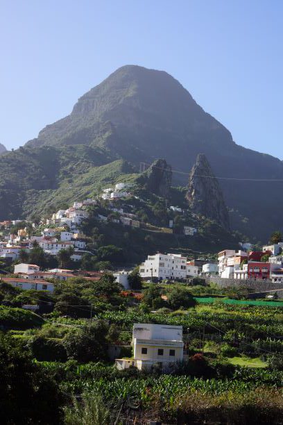
LA GOMERA – Canary Islands
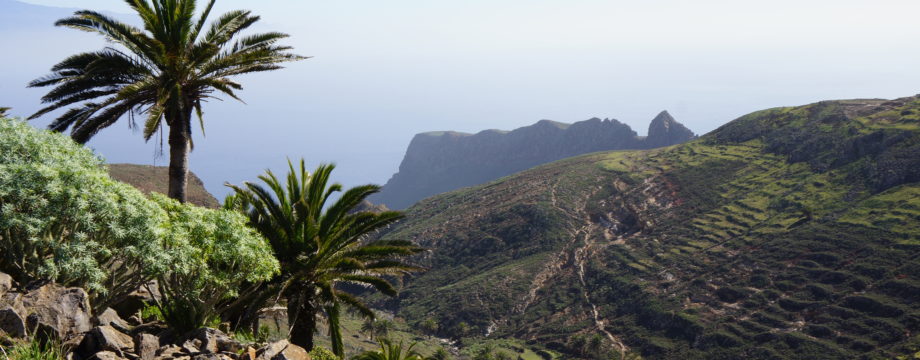
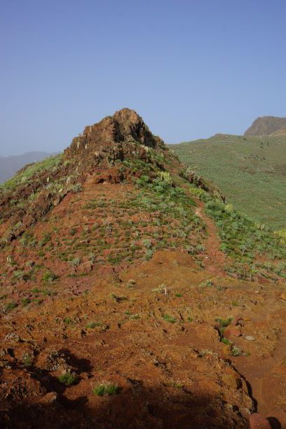
La Gomera is largely an unspoiled Canary Island. Because of the lack of any really good beaches it does not attract the tourist crowds that other islands do. There is an entirely different audience that this island appeals to. Some has described the island as a paradise for walkers, and this is not far from the truth. For the more experienced walker it has plenty of challenges, and it should have dramatic landscapes enough for all. Most walks are very well signposted, and the official paths are in superb maintenance.
Food in San Sebastián (the capital) tends to be simple, but well made. My favorite over a twenty year period is the “Restaurante 4 Caminos” (note that this restaurant has moved over the years).
Selected walks: For walks on Gomera take a look in Noel Rochford’s “Landscapes of La Gomera and Southern Tenerife” (Referred to below as “/Rochford/”, and PLEASE NOTE: when I refer to walk numbers etc. from this book they are taken from the 8th edition) and “Walk! La Gomera” by Jan Kostura and Charles Davis (Referred to below as “/Kostura & Davis/”. There is also “Walking in the Canaries Volume 1” by Paddy Dillon and “Gomera” by Klaus and Annette Wolfsperger. La Gomera is even mentioned in Lonely Planet’s “Walking in Spain”.
 •1 CAMINO FORESTAL DE MAJONA – CASAS DE CUEVAS BLANCAS – JARAGÁN – SAN SEBASTIÁN (my total time 4h57; 586a 986d; net walking time 4h22): This is a combination of walk 34 and 35 in /Rochford/. There is no reason to split this great hike into two separate walks when both can be done in one splendid day out. The most difficult thing on this walk could very well be to get off the bus at the right spot, almost impossible to judge exactly where you are. But the drivers seem to know where this “camino” is, and in addition there will probably be other walkers alighting at the same point. After that, no real difficulties until after Casas de Cuevas Blancas.
From the start, to avoid unnecessary climbing, use the TRACK. Also, I completely disagree with the book, use the OFFICIAL superbly maintained and signposted trail towards Casas de Cuevas Blancas (the danger and difficulty is EXAGGERATED). The alternative is not maintained at all, and is even hard to find. If you cannot walk the official route, you have no business here anyway, as the continuation after Casas de Cueavas Blancas is much worse, even if the book hardly mentions this.
The ridge you are supposed to climb after Casas de Cuevas Blancas is pretty steep. Not for the squeamish! Luckily there are now cairns to guide you. After that, walking towards Jaragán, follow a stony path to the right of a stone wall, pass on the upper side of a derelict stone building, then climb up to the plateau in front of you at the following pass (slightly up right), then turn left to Jaragán.
Down from this mountain, immediately turn sharp left on the marked main trail. Just follow the red and white markings and you will not need much more instructions to get safely back to town.
•2 SAN SEBASTIÁN – PLAYA DE LA GUANCHA – RISCO AMARGURA (+ return) (my total time 4h31; 634a 625d; net walking time 3h45): This follows part of walk 33 in /Rochford/ and returns the same way. Easy to find and follow, you can hardly get lost here.
The ascent to the Risco Amargura pass is very steep, but there is a guard rail at the most exposed point. A great view awaits.
As an alternative you might cut this walk short at the beach, or you might expand it to the next beach.
•3 PAJARITO – GARAJONAY – IMADA – EL RUMBAZO – PLAYA DE SANTIAGO (5h walking time): This used the be walk 17 alternative walk in /Rochford/ in editions up to the 6th. Today (as of 2018) there is no walk quite like this. A fantastic and at times a bit frightening walk this. But mostly easy to follow.
Actually the route is very easy to follow until well after Imada, where you are supposed to descend a steep ridge. The book says the path seems to “disappear” at this point. AFAIK there is now a SIGN at this point, so fork left and descend the marked footpath down into the valley, and continue on what is at least one of the most breathtaking paths I have ever seen. It never felt really dangerous, but do NOT continue here if the surface is at all wet! If you did you would make a very short career as a ski jumper (even without the skis) on this sometimes steep bare rock path.
Closing in on Guarimar, there are many confusing side paths. The instructions in the book does not take into account all this detail, and some of the side paths are also marked with cairns! But by following the book as best as I could AND ignoring those paths that did not look like the main trail, I happened to pick the right one at all times. Hopefully you will be able to do the same. The main route invariably just curves around the bends in the valley, and does not ascend or descend much, EXCEPT where noted in the book.
After El Rumbazo just stroll down to the coast along the road, it does NOT take 1 hour, not much more than half that time at my pace anyway. Hardly any traffic on this road, and a nice addition to the main walk! No purist would disgrace himself/herself with a taxi at this point. Imagine waking via the highest point on the island (1487m) and NOT having the satisfaction of continuing down to sea level when you are actually so close…
NOTE: I did this walk last in 2002!
•4 VALLEHERMOSO – ERMITA SANTA CLARA – PLAYA DE VALLEHERMOSO – VALLEHERMOSO (3h30 walking time): This is walk 42 in /Rochford/. Easy to find and easy to follow.
Sheer bliss, the most exhilarating views of all, and you can hear giant waves crashing heavily into the shore way, way below you. But do take care, the decent is steep and the drops are sheer. Even the bus ride to get to this place is just fantastic!
NOTE: I did this walk last in 2002!
•5 CASA DE LA SEDA – BARRANCO DE ARURE – CASA DE LA SEDA [- VALLE GRAN REY {- VUELTAS}] (1h15 [1h30 {1h45}] walking time): This is walk 10 in /Rochford/. Easy, fun and short.
On your return, be sure ignore the path that looks like a water channel, turning left when you are again nearing the end of the barranco. This path will only take you out and up on a higher road, not directly back down to Casa de la Seda from where you came. From Casa de la Seda it’s a fifteen minute stroll down the road to the Valle Gran Rey bus stop (as an alternative it is possible to walk in the river bed down to the roundabout in Valle Gran Rey, if you are allergic to road walking, but it did not look very interesting). In another fifteen minutes you can be at the beach, if you so pleases (e.g at Vueltas).
NOTE: I did this walk last in 2002!
 •6 SAN SEBASTIÁN – JARAGÁN – SAN SEBASTIÁN (my total time 4h59; 813a 806d; net walking time 4h05): This follows part of walk 34 in /Rochford/. This is similar to my walk 1 above, but with a start in San Sebtastián. The path is very well maintained and signposted (GR131).
The pass below the mountain is quite a big enough goal based from this starting point, as it is a bone crushing ascent. This is also a nice view point. But do expand it at will, if you are at all sufficiently fit.
There is also a new direct and signposted route towards Casas de Cuevas Blancas by continuing ahead instead of turning steep left up towards Jaragán, leaving the GR131. I have yet to explore this option, I fear it might be very scary.
 •7 SAN SEBASTIÁN – AYAMOSNA – SAN SEBASTIÁN (my total time 4h27; 733a 734d; net walking time 3h39): This follows part of walk 1 in /Kostura & Davis/. Very easy to find and follow, and the path is very well maintained and signposted (GR132).
Only difficulty, look out for aggressive dog(s) in the upper parts of town. You might want to stroll narrow streets and through a residential area on your left instead of continuing straight up using the sidewalk.
The ascent itself is gradual but long, and feels very tough indeed, slightly less tough though than my walk 6 above.
 •8 HERMIGUA – PLAYA DE SANTA CATALINA – HERMIGUA (my total time 2h50; 410a 383d; net walking time 2h18): An easy stroll. Part of this walk follow the official GR132, but I found the actual signs for that route more misleading than useful at my visit.
From the upper bus stop in Hermigua (Technically, I believe it is called El Convento here, just after the uppermost roundabout), cross the river valley on your right on a marked footpath and follow a narrow lonely street towards the coast. Your goal is the tiny dilapidated chapel of Santa Catalina which is currently not in any interesting state at all. Do however cross the bay in front of the chapel using the seaside track.
Return back up the way you came or any other preferred route, I would suggest using the track in the river bed this time.
If in doubt you can even stroll the promenade along the main street, to make this an extremely leisurely stroll. The bus stop for your return is slightly up the street (by that upper roundabout) from where you started. There is even a bus shelter here.
• Good starting points: • San Sebastián – from here buses will take you around to most of the island, and some walks can even be done right from town • Playa de Santiago – some walks are more accessible from here • Valle Gran Rey – some walks are easier to access from here
• How to get there: • By air (domestic only) • By ferry from Tenerife (Los Cristianos) • Even a few ferries from El Hierro and La Palma
• More info: Sorry, none yet
This page was last modified at March 7, 2026.
©2002-2026 .