GRAN CANARIA – Canary Islands
Gran Canaria may not be thought of as a typical walking holiday destination, suffering from a dubious reputation as a mass tourism island of the “worst” sort (depending on your preferences of course, this may be exactly what you are looking for). The truth is, and more and more are starting to discover this, the island is just terrific for walkers. Old “caminos” are restored, and waymarking is usually plentiful. And hardly anywhere in the world will you get landscapes as diverse as this packed into the same place.
If you can stand the city, Las Palmas is the best place to stay if you are planning to do a lot of walking in different areas of the island. Staying close to the San Telmo bus terminal is beneficial, and there are at least two very good hotels just in the neighborhood. Buses will take you to all of the northern/northeastern parts of the island, with its many great walks, and even the more remote areas of the south/southwest are within reach (but perhaps not very practical). If, on the other hand, you would like to get the most out of the sun and the sea and the sand, Maspalomas/Playa del Inglés is a better bet. You would still be able to do a fair amount of walking. If you want to do a lot of walking in just the mountain areas, staying at Cruz de Tejeda is another great experience. There are two hotels there. But you need to be dressed for the occasion, you will be at 1500 meters above sea level, and it can be very cold and windy as well as wet.
When it comes to eating in Las Palmas things are (as expected) not overly exciting. If you, as most tourists, are staying in the Las Canteras area, there is so much on offer within walking distance that it’s not really sensible to hunt around in other districts, this is a big city. But the menus tend to be very internationalized, too much of the same standard boring stuff everywhere. And some outlets are tarted up beyond belief. But the food is invariably eatable. For a really good dinner with good wine from a more international menu, try e.g the Gallo Feliz. Lunch with fish or other seafood is especially nice at La Oliva. If you for strategic reasons stay close to San Telmo on the other hand the situation is much more interesting and you will have some extremely good restaurants close by. I have not done much in gourmet style myself but I can especially recommend Kano 31. At Cruz de Tejeda I really like the Asador Grill de Yolanda. They might claim that their speciality is lamb, but their steaks are to die for… E.g try one with Roquefort sause. Very good local wines also. Down in Tejeda the ¡Déjate Llevar! is a must, here you can even get good tips for your walking. UPDATE: The restaurant is now closed but check their website for other offers. In Playa del Inglés variety is huge, but at the top of the line is the superb fish restaurant Rías Bajas. It has also an immensely cozy place for true Scandinavian home cooking at “Hos Pia”. UPDATE: This last one seems closed now. Both are at or close to the Avenida de Tirajana.
Walks accessible from Cruz de Tejeda
Selected walks: For walks on Gran Canaria take a look in Noel Rochford’s “Landscapes of Gran Canaria”. All references below are to this book (as “/Rochford/”, and PLEASE NOTE: when I refer to walk numbers etc. from this book they are all taken from the 6th edition). You should also check out “Walking in the Canaries Volume 2” by Paddy Dillon and “Gran Canaria” by Izabella Gavin.
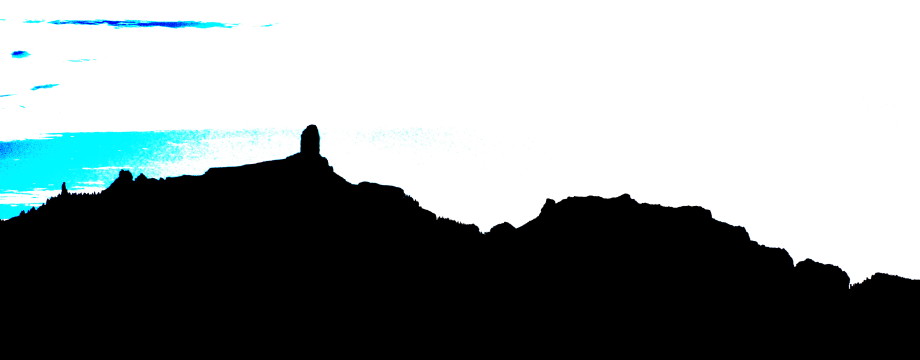
•CDT1 CRUZ DE TEJEDA – ROQUE NUBLO – CRUZ DE TEJEDA (my total time 6h50; 1342a 1334d; net walking time 5h41): This is a combination of the first part of walk 8 (twice) and walk 1 in /Rochford/. To not make this immense walk longer than necessary I returned from the rock via the “turn-off to the right” encountered “15 minutes up the path” from the GC600 parking area on walk 1 (see the map). This is where short walk 1 comes back in. If I had had definite plans of walking the entire way to the rock from the start I might have used parts of 7 alternative walk instead, avoiding some of the insane height differences encountered here. Down to and back up from La Culata twice is quite challenging…
•CDT2 CRUZ DE TEJEDA – TEJEDA (LOWER ROUTE) (my total time 1h31; 45a 484d; net walking time 1h11): This walk is not in the book, but is clearly waymarked. It goes right where walk 8 goes left at the very first fork. This is the lower and shortest route between Cruz de Tejeda and Tejeda. See CDT4 below for an alternative (longer) route. Almost a stroll this walk, relatively. But steep enough at points to require a modicum of care at least if it is wet.
•CDT3 CRUZ DE TEJEDA – ARTENARA – CRUZ DE TEJEDA (my total time 4h30; 960a 950d; net walking time 3h36): This is walk 4 in /Rochford/, twice. A suberb walk, and easy to find and follow. No guide book is necessary either, it is so well signposted. Do not get scared by the height difference, it is very gradual. The only steep part is a few minutes near the start (and end). And to be safe I cut any cave visits from the walk.
•CDT4 TEJEDA – CRUZ DE TEJEDA (UPPER ROUTE) (my total time 2h15; 722a 257d; net walking time 1h55): This walk is also not in the book, but is waymarked. From above, it goes right where walk 8 goes left at the second fork after Mirador de Becerra (this fork is not mentioned in the book). This is the higher route between Cruz de Tejeda and Tejeda. See CDT2 above for an alternative (shorter) route. But how to find the walk from Tejeda? I would not have found it if I did not get (even written down) instructions from Fernardo (a hiking enthusiast also) at the ¡Déjate Llevar! (see restaurant tips above). From the centre of Tejeda head in the direction of the cemetery, and later pass also a petrol station and a football stadium. Continue as far as the bridge, where the path you want goes up left. Ignore the first fork and just continue on. At the second fork follow the path towards “Roque Nublo”. All is pretty obvious, it must take you in the directions of the Mirador, high above you. After a while you are deposited on an asphalt road, you just cross it and continue up-up-up on the marked trail. Once up it is of course left towards Cruz de Tejeda.
•CDT5 CRUZ DE TEJEDA – LAS LAGUNETAS (my total time 1h13; 118a 451d; net walking time 0h57): This is the last third of walk 7 in /Rochford/. An easy walk, but be aware of very steep and potentially slippery streets as you enter the village area. I also intended to investigate further, but were stopped by heavy clouds and fog (see warnings in the book).
Walks accessible from Playa del Inglés
Selected walks: For walks on Gran Canaria take a look in Noel Rochford’s “Landscapes of Gran Canaria”. All references below are to this book (as “/Rochford/”, and PLEASE NOTE: when I refer to walk numbers etc. from this book they are all taken from the 6th edition). You should also check out “Walking in the Canaries Volume 2” by Paddy Dillon and “Gran Canaria” by Izabella Gavin.
•PDI1 ARTEARA – AQUALAND (my total time 5h07; 469a 737d; net walking time 4h22): This is walk 19 in /Rochford/. A nice opportunity to stretch your legs a little, after all those cramped mountain paths you can find elsewhere on the island. Let your legs roll. Enjoy the ENORMOUS canyon vistas along the way. For once a walk where you can walk and look around simultaneously. Normally this is suicide…
Note that the last part of the walk now goes a totally different route than in previous editions of the book to pick up the Los Palmitos bus at Aqualand. This is because the previous direct decent to Los Palmitos is fenced off, making the climb into that valley a complete waste. They have however not updated the title of the walk in the new book. BTW, outside Aqualand there is also a taxi rank…
•PDI2 PASEO COSTA CANARIA (my total time 1h54; 172a 167d; net walking time 1h43): The seaside promenade from Playa del Inglés to San Augustin is approximately 4kms (but goes even further) and can be followed for as long as you want and back. It starts at the hotel Riu Palace at the bottom of Avenida de Tirajana and is probably mentioned in every tourist guide in print. As expected there are plenty of opportunities for all kinds of refreshments en route. Wonderful views to the dunescape…
Walks accessible from Las Palmas
Selected walks: For walks on Gran Canaria take a look in Noel Rochford’s “Landscapes of Gran Canaria”. All references below are to this book (as “/Rochford/”, and PLEASE NOTE: when I refer to walk numbers etc. from this book they are all taken from the 6th edition). You should also check out “Walking in the Canaries Volume 2” by Paddy Dillon and “Gran Canaria” by Izabella Gavin.
•LP1 BANDAMA (my total time 3h14; 583a 580d; net walking time 2h39; Walking to/from the Guanche caves is excluded): This is walk 14 in /Rochford/. This very concentrated walk is a great appetizer, and is easy to find and follow. Except for the steep and awkward detour to the Guanche caves which I always cut from this walk. Also the crater floor should be visited LAST and the crater rim SECOND. Otherwise you would walk that road up to the rim path two times more than necessary (once in each direction). I do not understand the book’s logic here. But it is plain sailing, and you will see most of the area at all times, so it is quite impossible to get lost. /Rochford/‘s description of the initial path around the crater rim is not very good though. The path is OUTSIDE the rim when you climb the initial crest, after which it is exactly at the center of the rim (for good reasons).
•LP2 CRUZ DE TEJEDA – TEROR (my total time 3h35; 265a 1130d; net walking time 3h05): This is walk 6 in /Rochford/. The walk is mostly easy to find and follow. Time to get up into the mountains! Take a few minutes at Cruz de Tejeda to admire the view towards Rouque Nublo etc, before you head in the other direction. Only a few points have to be made: Although /Rochford/ grades this walk as “Easy”, the descent is often very steep, and the path stony and gravelly. Please do not compromise at all wrt footwear! Now for some tricks of the trail: When you cross the road at Cruz de Constantino you are not supposed to take the path that starts at the exact opposite side of the road and then curves left. Instead take the cobbled path descending a few meters on the right. Also make sure that, approaching Teror, you “keep straight down” just after the “beautiful stroll”. At the end of the walk, where you are supposed to shortcut the road, the map tracing (p.53) of the C42 is wrong, the C21/C42 crossroads is actually at that last curve of your road towards Teror, so the shortcut is BEFORE the crossroads, not AFTER as the map indicates. And important: The new bus station is situated a couple of hundred meters straight down from the old one the book directs you to.
•LP3 CRUZ DE TEJEDA – GUIA (my total time 5h14; 374a 1656d; net walking time 4h32): This is walk 5 in /Rochford/. To call this walk “easy” is quite a stretch when you see its height differences. And since big parts of it is unmarked it is also for the slightly adventurous. It is also very steep just after the Mirador de los Pinos de Gáldar. But no big problems en route. And a GREAT walk it is. Just notice that when you are deposited on the road again before the Montañón Negro there is NO path (OR I missed my turn-off to the right a few minutes earlier). Just continue through the woods at this point, or go RIGHT on the road to pick up some remains of a track going left after a minute or so.
•LP4 PUERTO DE LA LUZ AND LAS CANTERAS (my total time 1h35; 74a 75d; net walking time 1h23; Multiply by two if walking both ways): A walk for a day off. Start from San Telmo and stroll the harbour promenade. When you reach the Santa Catalina bus station you can cross to the Las Canteras side via the Santa Catalina Park (or somewhere else at your convenience) and then stroll the Las Canteras beach to its end. Take the bus back or return the same way adding a nice fish or seafood lunch on the way (recommended!).
•LP5 ARTENARA – LOS BERRAZALES (my total time 3h45): This is walk 25 in /Rochford/. It should be no problem finding and following this walk as long as you carefully read the map and the accompanying text. Finding the correct bus however, DID give me a small surprise, as the bus never arrived the advertised gate at the San Telmo bus station. But a small sign soon appeared in the front window of a bus at a neighboring gate (a bus towards Teror, as far as I remember), it turned out that on this day passengers towards Artenara had to change buses somewhere in the outskirts of Las Palmas. This was probably just an anomaly, just be aware. The walk is of great variety and beauty, one my greatest walking experiences to date, and is highly recommended. It is also very dramatic, and when you have succeeded with a careful slide down the last meters towards Los Berrazales, you will feel a certain degree of accomplishment. Take a few minutes to admire the view towards Rouque Bentaiga e.g from the left of the crossroads above the football field in Artenara before setting off on the actual trail. And do mind: Previous comments about footwear also goes for this walk.
OBS: I did this walk last in 2000!
•LP6 BARRANCO AZUAJE (my total time 2h50): This is walk 10 in /Rochford/. This “walk” was more of an experiment, but it turned out very nicely. It was great fun, climbing and sliding over cliffs and crawling under masses of bamboo, and should by no means be missed. I think the difficulties and the grade is exaggerated by /Rochford/ here. Just take your time and it will work out for the best. The path is not difficult to find and follow, the biggest problem might in fact be finding the correct bus in Arucas. The correct bus number on my visit was 118 (not 123 as suggested), and it was possible to take a “Direct Service” bus from Las Palmas to Arucas as an alternative to the one /Rochford/ suggests. And do mind to get off the number 118 bus at the correct place, as far as you can get inside that deep, deep barranco after Buen Lugar. Quite unmistakable really, and there IS a sign, but AFTER the spot where the bus normally stops. If the bus does not have a fatal accident before you can alight (in my mind, the bus ride must be the most risky part of even this adventure), the walk up the barranco will be a great thrill, in serene surroundings. After about 35 minutes of climbing, sliding and crawling you will reach the spring, where you can rest and enjoy the bird song for a few minutes before it’s time to turn back. Just after the spa, take the track down the barranco. This is a much easier part of the walk, it gets rather rough towards the end, but no big problems. There is only a little bit of confusion about the last part where you should leave the barranco bed for the last time to find the track for San Andres. Also mind that the timings are a bit off between the last two landmarks here. I used just about the same time as /Rochford/ for the entire walk, but found that I used about 50% longer time between these than suggested. So 5 mins between barranco bed and abandoned house, and 5 mins between house and you leaving the barranco both translates into 7-8 mins at my speed. The description in /Rochford/ is not very clear either, and I am not sure you really have to leave the barranco bed at all, you are after all just about 50m from your goal (the track) when the walls closes in and the barranco turns left. But I did not investigate. Inside the turn you have a water channel on your right, you will have seen it for a couple of minutes already, but do not mount it before a faint but still clear path takes you to it. Then climb the edge of the channel and use that as your road. Curve to the right, pass above a water cistern, then pick up a narrow path on the other side and continue for a few meters, then follow it down to a wider path which will take you to the rather overgrown track. In San Andres, cross the football field and take the stairs up on its RIGHT for the main road.
OBS: I did this walk last in 2000!
• Good starting points: • Las Palmas – from here buses will take you to most of the island • Maspalomas/Playa del Inglés – Enjoy the great sand dunes, buses will take you to walking opportunities in the southern part of the island • Cruz de Tejeda – stay in the thick of it all…
• How to get there: • By air • Some ferries from other Canary islands do exist
• More info: • Welcome to Gran Canaria, the official tourism website of Gran Canaria • Canaryforum has something for everyone coming to the Canary Islands, including airport transfers
This page was last modified at March 7, 2026.
©2000-2026