LA PALMA – Canary Islands
La Palma is perhaps the ultimate walker’s island, all things considered. A big island with many excellent walking opportunities (with even very good waymarking), good communications and not a lot of tourists. What more can you ask for. The main course is served.
As cities go, Santa Cruz is quite alright, with lots of space and no crowds. A few good and/or (at least) cheap restaurants should keep you satisfied for a while. While not particularly finding the places recommended in Lonely Planet to my taste, I found my own favorites in town: “La Azotea”, which is very cosy and with a very helpful English-speaking hostess and “Trattoria Antica”, where a full four course Italian dinner is very tempting. But if I would have to recommend just one place it would have to be “Restaurant Casa del Mar”, where they had the most extensive fish menu I have ever seen, with ditto white and (curiously enough) red wines. The food was very well prepared and also very genuine. This restaurant is in the “Casa del Mar” (where else?) about five minutes walk south of the center of Santa Cruz, with a “view” to the ugly harbour.
Selected walks: For walks on La Palma take a look in Noel Rochford’s “Landscapes of La Palma and El Hierro”. All references below are to this book (as “/Rochford/”, and PLEASE NOTE: when I refer to walk numbers etc. from this book they are all taken from the 2nd edition). You should also check out “Walk! La Palma” by Charles Davis and the “La Palma Tour & Trail Map” by David and Ros Brawn. There is also “Walking in the Canaries Volume 1” by Paddy Dillon and “La Palma” by Klaus and Annette Wolfsperger. Many other walking guides also exist, and are on sale on the island, most of them in German.
UPDATE: There is now a 3rd edition available of /Rochford/, where I have any comments at all I have included notes after each walk for users of this edition. Beware that these notes are not quality-tested in any way, but are made from my assumptions.
UPDATE 2: There is now even a 4th edition. I have not seen it, so I do not know the present relevance of my notes.
•1 LOMO DE LOS MESTRES – LA PARED VIEJA – REFUGIO EL PILAR – TF812 (VIA PARQUE NATURAL CUMBRE VIEJA) (4h05 walking time): This is walk 7 in /Rochford/, but only as far as the first bus stop on the TF812. A very pleasant and rather easy walk, through diverse landscapes, offering great variety. No big problems en route, just follow the instructions in the book.
You will have to take care to get off the bus at the right spot (i.e if the bus driver has forgot about you, the name of the bus stop is “Lomo de Los Mestres”, and it should be known by all the drivers). You will only have ONE SECOND to react when you actually SEE the (second) tunnel, after rounding a bend in high speed, before the bus disappears into it… Look out (right) for the “headlights on” road sign.
One other small thing, when approaching Montaña Quemada it might be better to head straight between this mountain and the Montaña de Enrique and just pick up the only path going downward between them. There are so many tracks here and they all look the same, you might as well disregard all of them, it is still obvious where you are actually heading.
UPDATE: In the third edition it is indicated that the bus stop at Lomo de Los Mestres has been discontinued, and you will have to take another bus (or walk, I am unsure about the safety of this, but at least bring a torch!) back through the tunnel where there still is a bus stop at the south side of the road. A couple of details are updated/added towards Montaña Quemada, you can have a go at it, or just follow my suggestion above.
•2 LOS SAUCES – MIRADOR DE LAS BARANDAS – BARLOVENTO (3h20 walking time): This is walk 2 in /Rochford/. A very interesting walk, with hardly any navigating problems under way. And all of the hairy parts are now secured by fences. Just mind that, at the starting point of the walk, the “Banco Santander” has moved to a location behind the park mentioned. At my visit I could still read the lettering on the old building, though. Most of the walk is also waymarked, but at the last stretches it turns against the signs, rounding the “Laguna de Barlovento” on its left side. The signed option here probably goes down to the recreation area to the right of the lake.
UPDATE: In the third edition the reference to the now missing bank has gone. Also the confusing signpost towards the Laguna is pointed out. All looks well then!
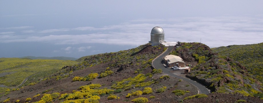
•3 NATIONAL PARK VISITORS CENTRE – ERMITA DE LA VIRGEN DEL PINO – REFUGIO DE LA PUNTA – DE LOS ROQUES (PLUS RETURN) (6h10 walking time): This is walk 6 Alternative 2 in /Rochford/. This is truly great stuff. But pretty tough, covering a total height difference of about 2500 meters, if you count both ways. The path is steep at points, but in excellent condition. One of my greatest walks ever. The only annoying thing was swarms of very small flies, on the return a hot day. Just follow your map/book, it is impossible to go wrong here, everything is obvious as well as waymarked. So just relax on the navigating and enjoy the great scenery.
•4 C830 (LOS TILOS TURN-OFF) – MIRADOR ESPIGÓN ATRAVESADO – BARRANCO DEL AGUA – MIRADOR DE LAS BARANDAS – LOS SAUCES (4h15 walking time). This is a combination of walk 4 Short Walk and walk 3 (excluding the “dangerous” part of the barranco) in /Rochford/. A “Grand Day Out” in the Barranco del Agua should not be missed. What a place that is! The options are many, and everyone should be able to piece together something that is suitable, regardless of skill and level of fitness. There are buses (to/from Santa Cruz) only every second hour (return at 13.50, 15.50 and 17.50 from Los Sauces), so you might as well fill the time available. The main walk, exactly as described in the book, was too short to fit the bus schedules well. My variation instead left me just 20 minutes slack before the bus went back.
After setting off from the main road, I located the entrance point for Rochford’s walk 4, shortly before Los Tilos. Then I followed that one to the first Mirador and returned the same way. You do not need a torch for the tunnel. Back at the Los Tilos road I then just continued on Rochford’s walk 3 to the end. But I chose NOT to climb the slippery rocks in the barranco. Mind also that nothing in the barranco bed is totally safe, at my visit there was water AND SMALL STONES coming in constantly from both sides… At least try to stay in the middle… But everything was as described in the book, you should not be able to go wrong. Enjoy!
•5 FUENCALIENTE – VOLCAN DE SAN ANTONIO – VOLCAN DE TENEGUIA (PLUS RETURN VIA THE “SHORT-CUT”) (2h20 walking time). This is a shortened version of walk 8 in /Rochford/, but with the added alternative return back to Fuencaliente, making it into a circular walk. Some obligatory volcano spotting… One slight put-down on this one is that the volcano of San Antonio has been turned into a tourist trap (yes, even on La Palma…), they are now charging an “entrance fee” of no less than 3€ just for walking the few meters up to the crater rim. If you happen to bring a car as well, and want to park at the parking lot by the volcano, they will no doubt turn your wallet inside out. Ok, you do get access to a small visitors centre, but for most people the only interesting things there will be the toilets, and possibly the bar, as the very small “exhibition” (nothing much more than a few information boards) is only in Spanish… But if you have the time and patience it should be possible to acquire a translation into e.g English, as well as watching a ten minute video about the volcanoes. If you are only here for the walking, and you are determined not to pay for that, you might try doing the main walk in REVERSE… My variation was a circular walk, doing the main walk as far as the second “crossroads” after Teneguia, then turning left. You can see this alternative return on Rochford’s map, it is also briefly mentioned in the text. Just mind that this short-cut, more of less mounting the slopes of San Antonio itself, is very strenuous, especially on a hot windless day. You will surely get blue in the face, and one step from a heart condition…
Oh yes, there is just one little thing to mention: The walk starts at the street going left just AFTER the “Bar Parada” (coming from the bus stop), not the one just before (there is actually no street OPPOSITE the bar). But you cannot go very wrong anyway, the directions are always pretty obvious. One slight change from the book: The water channel, as seen in the middle picture on page 74, was now covered with concrete blocks. After Teneguia it might be tempting to just take one of the tracks out straight towards the mentioned “short-cut” back, as this is so clearly seen on the hillside, thus cutting off the detour in and out of the lava flow itself. But you should not miss actually walking through that lava, it will only take a few minutes more, and there is a clearly marked path. Just don’t miss your exit, this is more faint here than from the tracks above. What a landscape!
UPDATE: In the third edition the outdated photograph of the water channel has been replaced. Still no mention of the “entrance fee”, but states a “small fee” (Yeah, I bet!) is payable if you want to park at the San Antonio. I still think the approach from Fuencaliente could have been more clear.
• Good starting points: • Santa Cruz de la Palma – from here buses will take you around to most of the island
• How to get there: • By air • By ferry from some other Canary islands
• More info: • “Finca Franceses” has accommodation ideal for walkers, you can also use the site as an entrance to walking information (e.g about the GR130)
This page was last modified at March 8, 2026.
©2002-2026 .