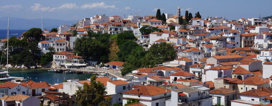
Σκιάθος – Sporades
Skiathos is a popular and pretty crowded island in season, but it has good beaches (also for nudism I hear).
At least it was well suited for walking in the past. Many of the old paths are now constantly run over by new dirt tracks so I am not sure how they all fit together anymore.
Skiathos Town is nice, but not the prettiest town in the Sporades. It has a bit more cosmopolitan feel to it than the other port towns and some might actually prefer this so that is mostly a matter of taste. There are many very good tavernas and restaurants and you will have a plethora of excellent choices.
Selected walks: In Marc Dubin’s out of print book “Trekking in Greece” (“/Dubin/”) trails are described but these walks must be approached quite differently today, as so much has changed. More current paths can be seen using the Anavasi “mapp”, unfortunately this map as of 2026 is also badly out of date with both paths and tracks. You will need to supply that one with Google Maps, which is fairly up to date but I might say very optimistic… Official routes and waymarking do exist but not all paths are actually maintained. I ended up in an overgrown maze of thorns myself, more on that below.
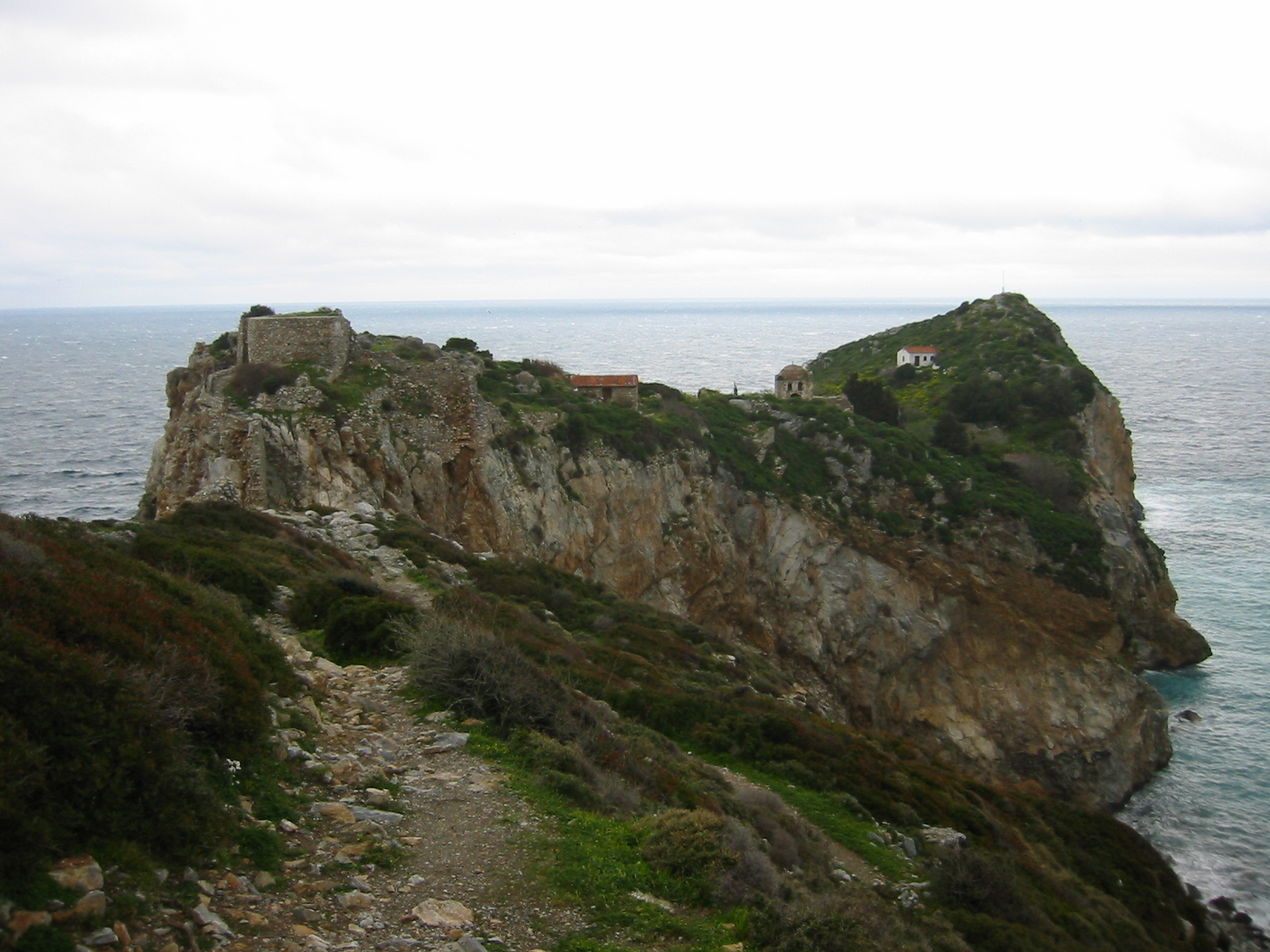
•1 MONI EVAGELISTRIAS AND THE KASTRO (my total time 4h41, includes short stops for photography, a small lunch and all the necessary sightseeing; +-936m, 2 laps): A long hike along main roads and tracks will take in most of what is described for both Trek 1 and 2 in /Dubin/ even if his original routes are too hard to find. Kastro is an insanely situated ruin town! From the small plaza/park in the harbour, the “Δημοτικό Πάρκο Σκιάθου” with its statue, I just followed the street inland from what is today “Bus Stop 0” initially towards the airport and then forked left, following road signs. On my return I turned right down towards the restaurant “Panorama” and followed that road back to town.
OBS: I did this walk last in 2003! All of the road routes has long since been covered in asphalt and I can no longer recommend doing this walk this way, even if it is an easy to find option not really requiring any specific map.
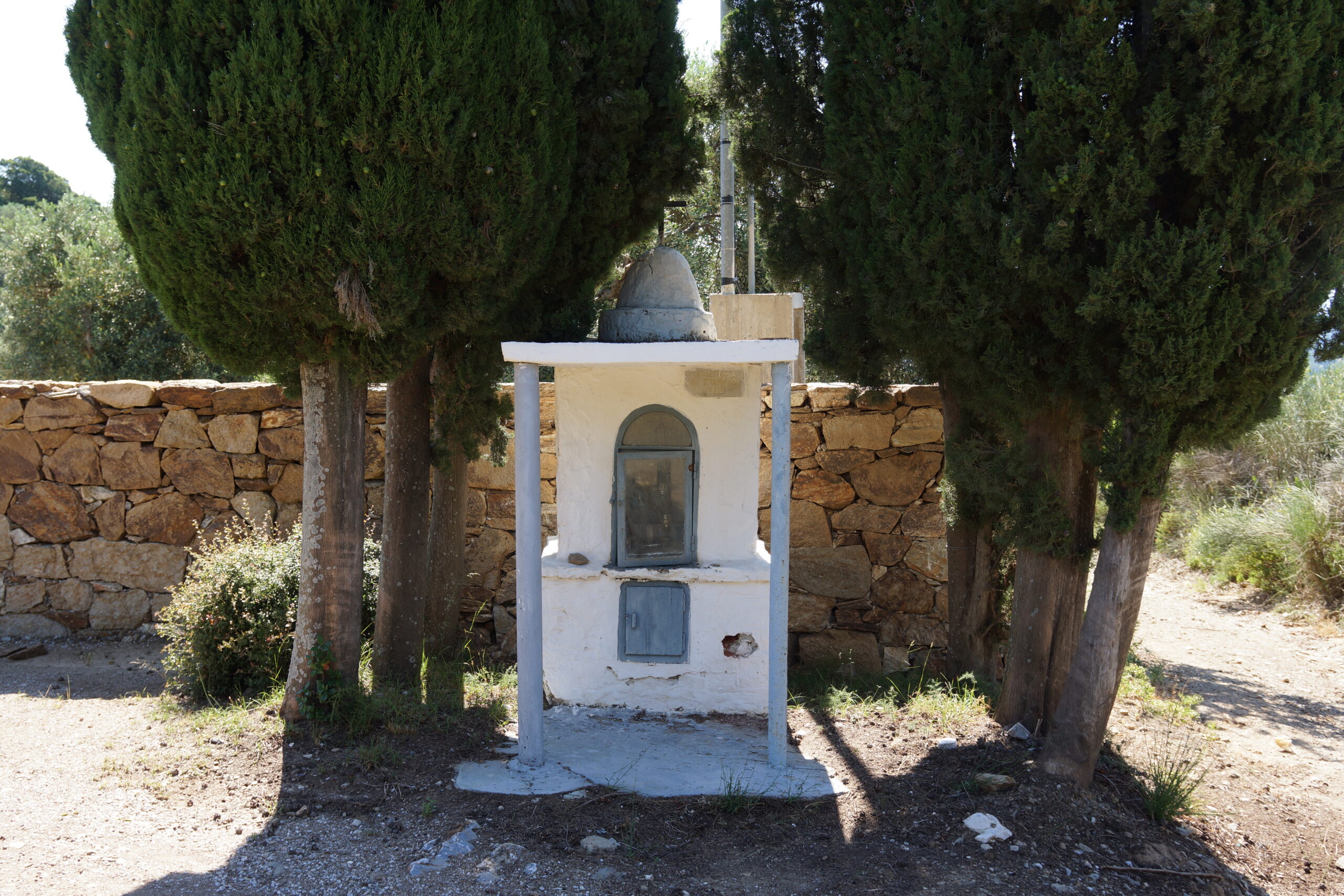
•2 AGIOS FANOURIOS AND THE PALIAGORTZA AREA (my total time 2h45): See the Anavasi “mapp”. Where the road ends a path continues on. Standing on that exact spot a path indeed went into the bushes. The road ahead is seemingly blocked by a new “resort”. Maybe you are allowed to pass by??? The path however turned right and ended at a gate so this is NOT the original path. After opening and closing the gate only faint traces of a path continues but shortly you will encounter a very steep and rough tractor road. Going left seemed to peter out, so I tried right. This narrow road/track eventually forks into two paths above some water tanks. Right went nowhere but a hard left will take you down to the water tanks. A track continues and you go through another gate to get down to a dirt road NOT ON THE MAP. Take this road right to get back to your original route, and keeping straight/left on a steep stony track instead of the concrete street right (where you most probably came up) you will pass by the shrine seen above. Soon you are back into town but if you follow Google Maps at this point you can see that a left fork will be an alternative route (which I used).
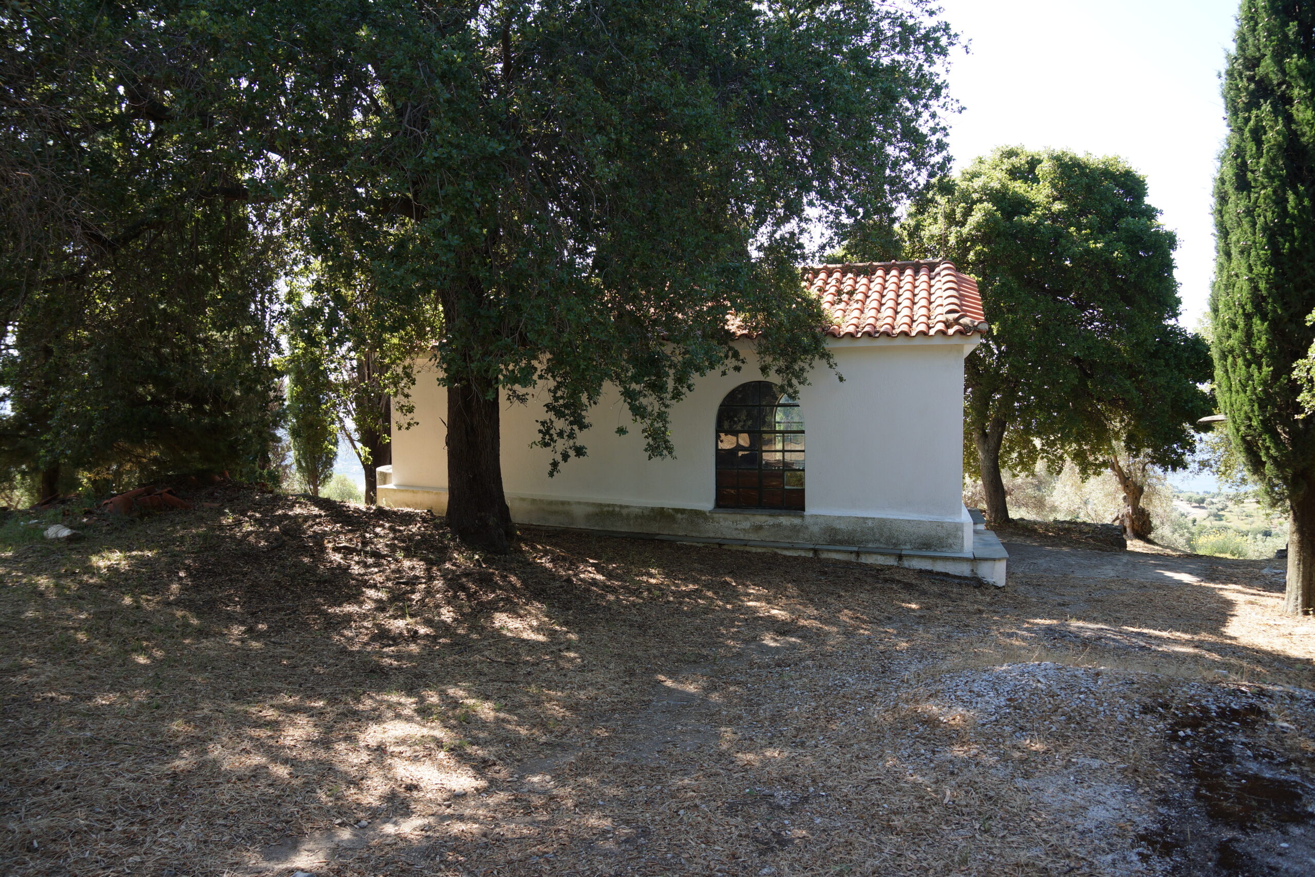
•3 AGIOS DIONISOS (my total time 3h50): See the Anavasi “mapp”. Slightly before (coming from the west) the bakery at the most northern point of the Skiathos town ring road (and an asphalt road signed for Evagelistria), official route 5 takes off left on a dirt track. This point is what is referred to as “Bus Stop 2” on the official routes. Shortly before the track ends (at some houses) route 5 goes sharp left and up into a very faint and overgrown path through a maze of thorns. You will have to negotiate this while an angry dog attacks the fence to your right to be able to get to you and kill you. Eventually the path improves and you fork right on a dirt road. Following the signed route the track more or less ends at a small ravine. I guess the official route goes up the creek (as you will understand when you come back here later in this walk, but no further markings were visible at this point), instead I crossed the creek and followed the overgrown tractor track continuing north. More fairly overgrown paths await you, but this is a very interesting route, passing a spring. If you become tired of overgrown paths you can eventually turn right and into the asphalt street and follow this left (I did that, and I do realize that all of this is a huge detour, but as I said quite an interesting one). Signs will reappear later, going steeply down a concrete street (there might be a shortcut through a gate way earlier, and according to the map, I did not check, it looked very closed). After the chapel you can continue west on another dirt road (this is actually the same dirt road NOT ON THE MAP from walk 2 above). A very nice marked path eventually turns left from this road and into the valley (before the point where you entered this road in walk 2 through a gate). Way, way down the valley and after you are back at the small ravine you will also pass the original route 5 sign for the thorn maze where you came up earlier. My advice is to completely disregard this sign and just continue on the track at this point and you will then run into my “alternative” return from walk 2.
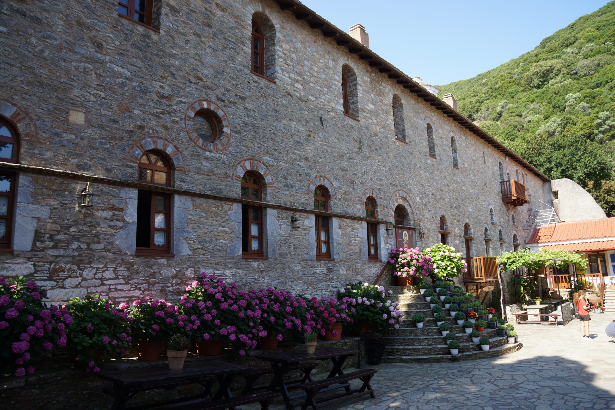
•4 MONI EVAGELISTRIAS (my total time 4h10): See the Anavasi “mapp”. This route starts just AFTER the bakery mentioned in walk 3 above (again coming from the west). Fairly straightforward but eventually quite a lot of road walking, fortunately not a lot of traffic. Do not miss the shortcut on a path/track down to the monastery (from the crossroads). After the monastery get back to the crossroads and continue on a fairly worn asphalt road until the sign for the restaurant “Panorama”. Turn left here. Eventually you can choose between just following the street (eventually ending up near “Bus Stop 2” and the bakery), or (MUCH nicer) do as I did, skirting Agios Dionisos again and going down that nice creek valley all as in walk 3 above.
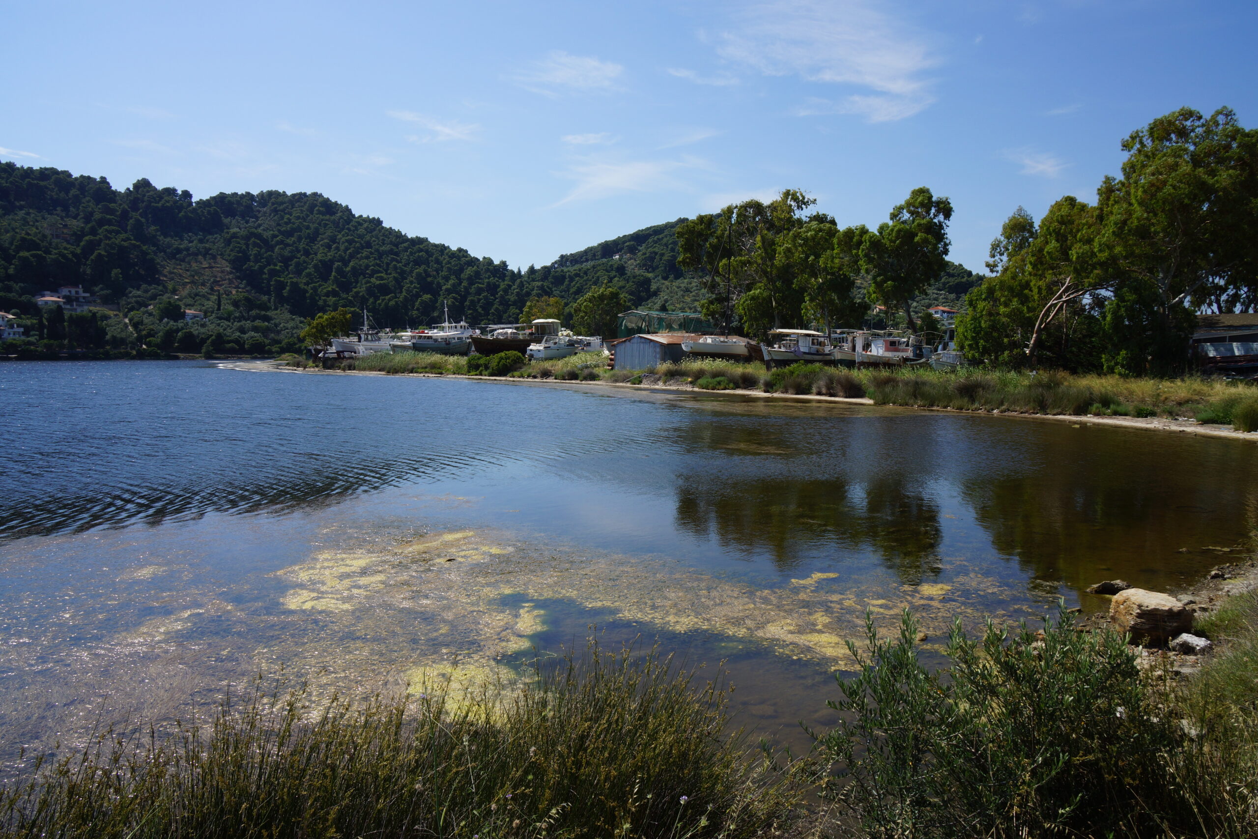
•5 FOURNAKIA AND LIMNI (my total time 2h10): See the Anavasi “mapp”. Unfortunately none of the streets went anywhere (I explored all of them) on this headland (well except from going to private and/or fenced off areas) but following official route 2A from the bridge you get to a really scrappy “beach” following a path. From the beach it is actually better to just turn back but you can continue (possibly wading) to some stairs or trespass (probably?) through a seemingly abandoned garden (go through a broken gate) where you turn slightly left and just walk over a downtrodden fence besides a locked gate. Back at the bridge area you can circle the lake, this is official route 2. Mostly road walking, and some traffic.
• Good starting points: • Skiathos Town
• How to get there: • By air • Excellent ferry/hydrofoil connections from the other islands in the Sporades • By ferry/hydrofoil from the mainland
• More info: Sorry, none yet
This page was last modified at July 4, 2026.
©1997-2026