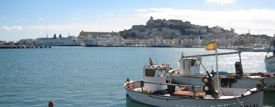
IBIZA – Balearic Islands
Probably would not have suited me in summer this island, but lends itself to many good walks and nice strolls in winter or at least off-season. Many fantastic coastal landscapes that are interesting to behold in all kinds of weather.
For staying and eating follow e.g the advice in the “Mini Rough Guide – Ibiza & Formentera”. If you come in winter you may however find that most of the restaurants the guide claims are open all year round are actually closed. The only one of these I could find open was “La Brasa”, and I think you could choose better. Today the place looks rather run-down, and the food cannot justify its pretty big price tag. Just as pricey, but better was “Rincón del Puerto” at Carrer d’Enmig and the old “Ca n’Alfredo” at Passeig Vara de Rey. Around Carnival time also the rather classy “Restaurant Formentera” in the harbour suddenly opened (you will find it just across the road from the pier).
Selected walks: For walks on Ibiza see “Landscapes of Mallorca and Formentera” by Hans Losse. PLEASE NOTE: when I refer to walk numbers etc. from this book (as “/Losse/”) they are all taken from the 1995 2nd edition, you will also need the 31/10/2000 Update Sheet. When using this book you should always carry a compass, because the author has put in many helpful compass directions to make it easier for you to find your way. Essential on an island where things change so rapidly because of development. The Rough Guide by Iain Stuart mentioned above contains some walks (referred to as /Stewart/).
UPDATE: Since they are currently NOT planning to update (or even reprint) the book by /Losse/, my notes below are kindly offered by Sunflower as their 28/03/2003 Update Sheet.
UPDATE 2: There is now (2007) AT LAST a 3rd edition available. Hopefully that one can replace all my updates and corrections.
•1 HILLS NORTHEAST OF IBIZA TOWN (my total time 5h28, includes a short breakfast and lunch and a lot of trying and failing; +-535m, 2 laps). This is Walk 2 in /Losse/, with the initial added walk from Ibiza town from Walk 1. Timings in the text below refer to those in the book. For comments on Walk 1, see the last walk below. As those comments also say, my time is from/to the pier in Ibiza town (the real pier, not the embarkation point for Formentera used in the book as starting point for Walk 1, well these are only a minute or two apart…).
As I have stated before, the first walk on any island usually goes wrong. In this case it was mostly that the walk as described in the book is no longer possible. Development or even dynamite has made the most interesting parts of this walk disappear.
When I used Walk 1 as a way of getting to Talamanca, as mentioned in the comments, I went straight from the Botafoc Marina to Talamanca beach. On Talamanca there is now a wooden walkway in the back of the beach all the way from the Bar Flotante. When you step off the walkway, you are on the Talamanca Promenade (called “walkway” in the book). From Talamanca, the way is initially easy to find. The “Paraiso del Mar” is still the last hotel, even if the name is in shatters and is a bit difficult to read. I believe there are more forks than described in the book, but the directions are pretty obvious anyway. At 37 minutes the red emblem on the blue arch is now gone. A house has been built on the small hill (40 minutes) to disturb things, keep ahead in the proper compass direction (NE), do not turn up left by the house, wait until you are over the hill as the book says. The paths on the other side will take you down left to the asphalt lane, but a little to the right (uphill) of the two tracks forking off. Walk downhill on the lane for about 30m to find the situation exactly as described in the book (Actually, you could also turn right, to omit this little detour, you WILL be back at this lane later, just 100m or so further uphill). Follow the track as described, but when you finally hit another asphalt lane you will need to take this to the right downhill, until you are back on the one encountered before, then turn left and pick up the instructions again. Soon you pass Josep Lluis Sert and German R Arias as described.
The asphalt (and development) has been extended and now does not stop until your are at a new building site just around were the old track used to stop (my guess). Here all traces vanish. Things COULD be put in order here when the work has finished, but do not count on it. For now you will have to turn back. But by all means go up here for the view. The picture on the right is Sa Talaia as seen from Walk 3. You can even just spot the building site (gray area near the top).
If you want to continue further you will have to walk around the hill and pick up the path on the other side. This is possible by referring to the map on page 36. Walk down from Sa Talaia and aim for the saddle between this hill and the next one (the much smaller hill next in line towards the coast, Puig Manya is the name on the map). As you can probably see there is a dirt track running straight east in the saddle between these hills. At a crossroads not long after the pass another fairly straight dirt track takes off left. These tracks are still here, and when you finally fork off left again to a labyrinth of tracks to get to the back of Sa Talaia keep left and downhill (the path will come down from uphill here somewhere, I am not sure about the precise point). Skip all instructions in the book here, keep left and downhill to get down to the asphalt road the best you can. The direction is pretty obvious. Down on the road turn right.
The next bit does not constitute any problem, but when you are close to the quarry entrance, the track AT the entrance itself is the correct one to take to the right (not the one 30m or so before). You cannot see this track before you are actually there.
You soon pass the farmhouse (beware, lots of dogs in all sizes on the loose…). Read the instructions carefully. Just above the farmhouse turn right uphill.
At the next quarry the path to the right has been eaten up. You can go a few meters if you want, but be careful! Instead turn left at once. The path forking off at 1h53 now goes nowhere. Or it just drops into the first quarry, which has eaten this whole area up… You have two options, either return the way you came (probably the best), or continuing on the wide track (which was what I did, not the best of choices, I think). The wide track takes you down to the entrance of second quarry, where you can walk out on the main road (right) and then turn left. More than an hour of asphalt between you and the harbour in Ibiza town. Not very suitable for walking, really, so not pleasant. You can leave the main road for some more relaxed walking for a while by some suburb/housing estate.
There ARE other tracks from the quarry entrance (left, you can also see some on the map). It should be possible to use some of these towards town instead, but at this point I was tired of my private investigations…
•2 COASTAL LANDSCAPES NORTHEAST OF IBIZA TOWN (my total time 4h49, includes a short breakfast and lunch; +-300m, 2 laps). This is Walk 3 in /Losse/ as far as Cala d’Espart, with the initial added walk from Ibiza town from Walk 1 + RETURNING THE SAME WAY. For comments on Walk 1, see the last walk below. Again, my time is from/to the pier in Ibiza town. Same initial comments as for the walk above, but at the “Paraiso del Mar” continue straight ahead (rightish).
Not too much difficulties, but you must follow the book (and Update!) VERY carefully. At Cap Martinet you must round a big concrete building on the left side before continuing out to the very interesting cliffs. There are “steps” down (hunt around the cliff edge to the right of the actual cape)! But be very careful. I feel this is NOT a mandatory part of the walk. I did this bit twice during my stay, but not everyone will feel comfortable with this.
Downhill to the next beach the going is steep and slippery and walking boots will be the best choice. From here keep to the text in the Update, which is much more precise. After crossing a set of smaller fissures, when you find the concrete arrow (1h05), I think the book again is more precise than the Update… At the arrow do not continue up to the wall, but find the narrow path going right on the cliff edge. When it forks you can take either way down towards the kiln and a much improved path. You pass a giant fissure here, but this time you thankfully doesn’t have to cross it.
I turned around at Cala d’Espart.
•3 GARDENS AND WOODS WEST OF IBIZA TOWN (my total time 4h48, includes a short breakfast and lunch, short stops for photography; +-440m, 1 lap). This is Walk 4 in /Losse/.
Some navigation on this walk was not easy, and a short stretch of overgrown and steep path was difficult. Initially (15mins) stick closely to the Update. And yes, it does not matter where you cross the main road, as long as you do it before the track on the other side goes away to the left. It will do so very shortly after the football stadium. So when you are on the right (i.e left-hand) track, just continue in the obvious direction without forking right or left until you hit the glassworks, where you turn left immediately up the stream bed.
Later, after the long, winding and ugly dirt road, with lots of heavy vehicles to and from the quarry, do NOT pass the entrance, if you did that you would be trespassing. Instead turn right, where the Update says you should not(!), THEN turn immediately left, to enter a muddy area with lots of water erosion in front of you. The track originally used for this walk then comes down from your left (my guess, anyway). Cross the small area to its right-hand side and find another path/stream bed cutting between two hills. This will soon pass the described kilns. The picture down on the right is from this valley, not very long before turning up left in the side valley.
Be very aware of the 1h12 point where a small and not very visible path heads up left, to the right of a small side valley. Do NOT try to cross the stream bed in this narrow valley, continue up ahead right(ish) on the little remains you can find of this overgrown path. Head for the clearly visible pylons at the top of the pass, here turn right on a good path.
Now it is more enjoyment, instructions are pretty clear, but read them carefully, and always refer to the map also.
At the 2h48 point new roads were being built up, but it was still easy to see what used to be the old road, and just follow that one. At 3h24 just cross the road and continue downhill. There is no need to get all “tangled” up here, instead just turn left when you get to e.g Carrer des Canar to get straight back to Carrer Des Jondal, where the walk began.
•4 SAN ANTONIO TO IBIZA TOWN (my total time 4h10, includes a very short lunch and some short stops for photography and snacks; +-278m, 1 lap; net walking time about 3h45). This is Walk 11 in /Losse/, but ending the walk in Ibiza town. What should have been a very easy walk turned out a nightmare to navigate. The timings above are from my SECOND attempt (first attempt was 5h27, includes a short lunch and lots of investigation and wrong turns; +-355m, 1 lap). The main problem with this walk is that the map tracing and the text does not coincide, and on the map it was impossible to discern what was tarmac road and what was track. I have later come to the conclusion that the map tracing was technically correct (mostly), but the text impossible to relate to it. All this left me with absolutely no confidence in the book, and I just continued on the tarmac road for the whole walk, ending up not in the direction of Puig d’en Valls, but well above Monte Cristo. There I just crossed the main road then stitched together what I could find of tracks and nice roads to get over the hill with its huge statue of Christ, then rejoined the route at Puig d’en Valls and the windmill. One of the crucial sentences in the book is this (even if the map is correct here, and is easy to understand): “In 2h24min the track turns left to the other side of the Torrent des Fornas: here fork right”… Now does this mean you turn right BEFORE or AFTER the stream? I thought at the T-junction AFTER, believing the map was still totally off. It really meant BEFORE… Someone sure laid a big egg on this walk, but was it me???
But let us go through the whole walk. The initial map tracing from San Antonio on page 76 is also wrong, the walk does not cross the green(ish) area full of reeds, but continues to the crossroads where it turns left.
Then things go well for a while, but the map tracing seems to go wild around the 1h20 point. This is because the text tells you to “go left” where the “asphalt lane turns right”. Unfortunately the asphalt lane does NOT turn right at this point, it just ever so slightly turns towards the right. The easiest is to do as I and “User, 10/95” did, just continue on the tarmac road and wait for the proper crossroads, because that WILL lead you up to the Col. It makes for fast walking and there is hardly any traffic.
IF you manage to turn left at the correct 1h20 point you will have another problem at the 1h33 point which is in fact a double staggered crossroads, no less… You are supposed to continue up the valley using the track continuing on the left (forget about the track on the right as well as the crossing lane). The track will eventually split into three, where the rightmost option will take you back up to the road, more or less AT the footpath shortcut (see picture right).
When the road is innermost in the valley you CAN shortcut it by following a footpath to the left of some fields (see picture right, you can just spot the read clay path up there). Rejoin the road a couple of minutes later on the hillside, and in one minute later you are at the Col (= pass).
Now it’s easy until Puig d’en Valls, but follow the book (and map) carefully. Especially make sure you get it right at the crucial 2h24 point (see my comment above). Down from the windmill turn left on a track going (initially) in the direction of the three huge gas tanks on the other side of the main road. Then curve right through (more or less) a garbage heap to get down to the road. Cross it by a figure of a stegosaurus (or was it actually a triceratops, I cannot seem to remember now), then pass through the industrial area straight ahead. At the next heavily trafficked road turn right and cross it carefully via the long green traffic island. Continue down to the right and head for the seaside promenade by the casino. Turn right for town (left for Talamanca).
•5 COASTAL LANDSCAPES NORTH OF SAN ANTONIO (my total time 3h05, includes only short stops, but also some investigation; +-217m, 1 lap). This is Walk 13 in /Losse/, but the walk now ends at Sa Galera. The “Author, 10/95” makes a useful change at the beginning of this walk, throwing you straight onto a coastal path just meters from the bus stop. Great. The walk is pretty easy to follow as far as I went. There are a few diversions, but I believe they are all mentioned in the text. It felt a bit unclear at points, though. What “Users, 10/99, 11/99” experienced I believe is the beach just after Sa Galera. Here there is an overgrown path, and the scramble down is horrible. This is where I returned, I could not find another way, and I think it is safe to say that the walk now ends at Sa Galera (picture left). Great coastline here, by the way.
•6 COASTAL LANDSCAPES SOUTH OF SANTA EULARIA (my total time 4h47, includes only short breaks, some time for photography, and some investigation; +-701m, 4 laps). This is a union of Walk 15 and 16 in /Losse/. I did walk 15 out, then returned to the fork at 0h44 and did walk 16 back in (golfers are we?). Easy to follow initially, but look out for the 0h44 fork, La Torre is not visible at this precise point. After 50m or so you will see it again. The Update does not have anything essential to contribute, and one “User, 10/00” must have taken the wrong fork, and found the “ridge route” down towards Cala Llonga (this route is briefly mentioned under Walk 16).
Down towards the tunnel there is a choice of paths it seems, the right-hand (blue arrows) path followed in the book, and a steeper one straight (are you kidding?) down. Pick one of your choice. The picture on the right is the view towards the tunnel from above the beach. It’s still a bit of a scramble down to the beach itself.
The rest of the way to Cala Llonga should be easy, all is waymarked, and the instructions are quite sufficient.
Back at the 0h44 fork, walk 16 takes off to the right on a heavily waymarked footpath a bit up the road. The important 1h05 fork however, is NOT waymarked, instead it is blocked by a line of stones, indicating that this path is now disused (and it should be…). I did not get the instructions to quite match after this, but it is just to keep ahead in the obvious direction.
Down towards Santa Eularia things are a mess because of new development. I was just able to scramble down on the building site highest up on the right. Luckily the gate was open so I could get out. Very soon there will be no way through here, it seems. The original path is also long since gone, most probably.
•7 COASTAL LANDSCAPES SOUTH OF IBIZA TOWN (my total time 6h23, includes a short breakfast and lunch; +-540m, 1 lap). This is Walk 5 in /Losse/, with the added walk to/from Ibiza town. The net walking time for Walk 5 as such is only 2h16. If you want to do just Walk 5 in winter you can use city bus line 31, which SEEMED to go all the way to Platja d’en Bossa before turning around. The ordinary Platja d’en Bossa bus only runs in summer.
Start off by taking the “Scenic Walk to Figueretes” in /Stewart/. Then walk on the promenade and lanes towards Platja d’en Bossa as you like.
Walk 5 in itself starts at Platja d’en Bossa and is pretty easy to navigate. At the 0h17 point you should probably stay on the UPPER path, not the now more disused and overgrown lower one. By the bar at the 1h42 point don’t waste time hunting for tracks, head straight for the Torre de ses Portes (picture left) by just walking along the beach.
Walk 5 ends at Platja de Migjorn, but there is no bus from there in winter, you will have at least to walk back to Platja d’en Bossa. So walk the road towards the salt-pans and pick up the red walking posts. Later just continue on the main road towards San Francisco de Paula, and fork off on a track towards the Torre de Sal Rossa (signposted), the 0h9 point of Walk 5. Just return from there the way you came.
•8 GARDENS AND WOODS NORTH OF SANTA EULARIA (my total time 3h27, includes only short snack breaks; +-150, 1 lap; net walking time 3h09). This is Walk 19 in /Losse/. A mostly idyllic and easy stroll that is easy to follow if you read the book and map carefully. Carry a compass to confirm directions, and if you in addition follow your progression on the map, there should be little doubt along the way. Take a look at the Update as well.
•9 SANTA EULARIA AND PUIG DE NA MOSSONA (my total time 2h05, includes a couple of short snack break and general sightseeing; +220m -211m, 1 lap; net walking time 1h28). This is Walk 18 in /Losse/. Mostly an easy stroll, but the path to Puig de na Mossona is stony, steep and slippery if wet. By no means suited for “lightweight shoes”! Good grief…
After the Roman bridge, you only need to walk the road for a few meters before taking off upwards to the left on new signposted stairs towards Puig de Missa.
Because of development the path to Puig de na Mossona is difficult to find, even if you can see it clearly from the distance. Carefully study the Update here, and you should find your way.
•10 COASTAL LANDSCAPES NORTHEAST OF SANTA EULARIA (my total time 1h43, includes a short breakfast; +106m -94m, 0 laps; net walking time 1h28). This is Walk 17 in /Losse/.
The Hotel Los Loros is now a Sol hotel and there is no paved path. I think you have no option but to walk around this hotel to the left.
“You walk between the cliff-edge and a wall with a fence on the top” – the sea has eaten up the narrow path in places, but it is only one meter down to the beach at this point. Wade if necessary.
“User, 10/00” is wrong, there IS a way through Club Punta Arabi (in winter, at least). You enter through an open gate, the way out is only 15m or so ahead on the right, also an open gate.
You can even continue for about 50m after the Club, as the coastal path actually continues. Then the path ends by a wall. Pass through a gate/opening between two fences here, turn left down the road, pass through another (hopefully open) gate, and voilá you’re in Es Canar.
•11 SAN JOSÉ – SA TALAIASSA – ROUQES ALTES – ES VEDRÀ VIEW – SAN JOSÉ (my total time 4h27, includes a short breakfast, some snack breaks, and some investigation on the return; +-553, 4 laps). This is Walk 7 (Alternative walk) in /Losse/, with the alternative return from the Update Sheet.
The map shows the initial path on the right flank of the first hill. The signposted footpath now uses tracks on its left side. No other comments are necessary for the walk as described in the book but to say that the path up is steep and possibly slippery. Walking boots preferable.
The claimed signposted return (using the “shorter circuit”) from the Update was not extremely easy to find, there were no walking posts visible from the road. But they did turn up, eventually. I think the distance from the main tarmac road is also closer to 400 than 300 meters. All other tracks went dead shortly.
•12 COASTAL LANDSCAPES NORTHEAST OF ES CANAR (my total time 5h21, includes a short breakfast and lunch; +-439, 3 laps). This walk uses the first half of Walk 20 in /Losse/, followed by Walk 23, then returning to Es Canar with the first half of Walk 20 in reverse.
An excellent combination of coastal walks. Just follow the instructions in the book, also refer to the Updates, and you should find your way. There is also a lot of waymarking to help you. Use the instructions for Walk 20 to find your way to beach below the Sa Sení restaurant. From there just continue on the coastal path, which is now Walk 23.
A few notes on the Walk 20 part: At Cala Llenya (0h45) use the SECOND set of stairs out. A little bit later “when you get to the bottom keep left” means turn SHARP left. You enter Club Playa Azul via a small parking area (unofficial?) with a supermarket to your left. You turn right on the road and curve counterclockwise around this small resort. Finally (after a 180+ degree curve) you will pass the Azul Restaurant where you fork right on a now asphalt lane. Before going ahead be sure to take a rest at the small bay mentioned, it will only take a few extra minutes. Afterwards just return to the road. Use the Update to continue and find the footpath down to Cala Mastella (the Sa Sení restaurant is signposted from there if you feel hungry at this point).
From this beach you are on Walk 23: With the new road the path after the 0h25 point is little used. The blue marker arrow has also been crossed out down in the first bay (picture right). Indeed, the path towards the second bay is overgrown and difficult. I turned left and headed for the road again at this point.
After Cala de Boix be specially careful, there are many tracks and paths and it’s easy to go wrong. Follow the instructions carefully, and there WILL be waymarks at many crucial points. The footpath is a bit overgrown a short stretch, but don’t despair, things will soon improve. The iron gate at the 1h11 point lay rusting on the ground.
On the return form the tower I could not really see a coastal path past those restaurants. If you are not going to visit them, just follow the road, this is only a very short stretch anyway. At the second restaurant be sure to spot waymarking on the “farm track”. “The track bends left in front of a gate”: No, it STOPS at the gate. A footpath forks off 90 degrees left from this point.
It is of little use to take the path going by Can Michel Pere. The path just ends in a field where you on the other side can see another blue arrow pointing left on a stone wall. Cross the field, follow the wall left and climb out on a lane when you come to the end. By following the lane on the other side of that wall, you are soon back on the main road. This detour adds little to the walk and can just be omitted in my mind.
•13 IBIZA TOWN – BOTAFOC – TALAMANCA (walking time probably about 1h as described in the book, about 45mins is what is possible at the moment, about 30mins straight to Talamanca beach). This is Walk 1 in /Losse/. At the time of writing the Botafoc part of this walk was not possible to do. There were loads of building activities in the area, and the road out to the island was temporarily closed for public use. But there are still some nice views, so by all means do as much of it as you can.
I started the walk at the pier in Ibiza town (the real pier, not the embarkation point for Formentera used in the book. There is really no pier there.
The “Aparthotel Río” has probably changed its name, or at least no such name was visible. Instead follow the signs towards the casino.
100m or so before Hotel El Corso, at a crossroads (at time of writing another area with building activities and road work), turn left and walk by the bus stop (to head straight for Talamanca beach, I did this to continue with Walk 2 and 3), OR turn right and skirt the building site (if possible, to continue Walk 1).
Walk 1 then goes left just before the hotel, then immediately right. Keep in that direction as long as you can, then turn left for the dirt track.
As I have already stated, the Botafoc island was out of bounds during my visit, and I could not get further than the entrance of this building site without trespassing. The picture above left is towards the Botafoc lighthouse, with the building site on the right.
The ferry only runs in summer, but there is also a bus (city bus line 31, I believe this departs from Paseo Vara del Rey, not from the regular bus station/street) with hourly departures even in winter. If you don’t want to walk both ways, you can take this to or from e.g the bus stop mentioned above, which I now for a fact is operational. During my visit they were also just putting up a new bus shelter by the beach itself.
• Good starting points: • Eivissa (Ibiza Town) – from here bus will take you around to the entire island
• How to get there: • By air • By ferry from other Balearic islands
• More info: • Bus timetables can be found at ibizabus.com • Hotels and restaurants in Ibiza Town • Ibiza guide
This page was last modified at March 7, 2026.
©2003-2026