The Bailiwick of Guernsey – The Channel Islands
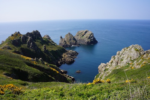
Guernsey is another green and pleasant Channel Island, excellent for doing some very nice strolls. Easily accessible are also two superb smaller islands inside of this bailiwick (see Sark and Herm).
Good food seems to be available just everywhere. Personal favorites: Da Nello and The Swan, both in St Peter Port.
Many nice hotels available at a decent price, I got a particularly good deal at The Clubhouse @ La Colinette in St Peter Port.
Selected walks: For walks on Guernsey see “Landscapes of Guernsey” by Geoff Daniel and “Walking on Guernsey” by Paddy Dillon. PLEASE NOTE: when I refer to walk numbers etc. from this book (as “/Daniel/”) they are all taken from the 5th edition. I refer to the latter book below as /Dillon/.
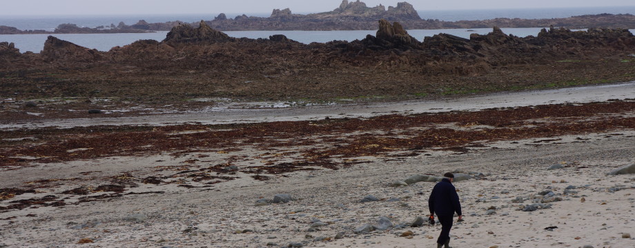
•1 ST. PETER PORT – FERMAIN BAY – JERBOURG – MOULIN HUET BAY – CALAIS – FERMAIN BAY – ST. PETER PORT (my total time 3h41; 674a 669d; net walking time 2h44). This is Walk 2 Alt + a part of Walk 3 (in reverse), then a part of Walks 3/4 Alt (in reverse), then part of Walk 3 Alt (in reverse) and finally most of Walk 2 Alt again (this time in reverse) in /Daniel/. If you look at the walking map this will actually make all sorts of sense, believe me. For various reasons the Walk 2 “Cemetery and Memorial” was cut from my walk both coming from and going back to St. Peter Port. But I did a small diversion anyway, up to Doyle Column, which is fairly unnecessary and does not actually add anything too interesting to the walk, except for a decent view back to St. Peter Port. Instead try to follow the coast as much as possible the entire way to Jerbourg (do not be afraid, you will notice when you are there). So careful navigation using the map and the instructions in the book is needed, but expect no big problems.
•2 ST. PETER PORT (my total time 1h13; 158a 160d; net walking time 0h58). This is Walk 1 in /Daniel/. This rainy Sunday stroll did not include any actual visits to sites. Mind that the detailed street navigation in the book is almost impossible to follow since no indication of the route is added to the town map.
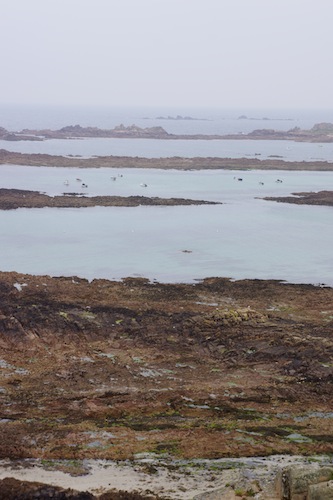
•3 FORT PEMBROKE – VALE CHURCH – DEHUS DOLMEN – FORT DOYLE – FORT PEMBROKE (my total time 2h45; 241a 237d; net walking time 2h06). This is Walk 9 in /Daniel/, but starting/ending at Fort Pembroke, where the bus turns around. This has the benefit not only of being a much more noticeable bus stop (you just cannot miss this as the bus halts here for a while before returning), but there will even be 50% more buses available back to St. Peter Port (2013). This is because not all buses returns via L’Ancresse. Some of the detailed street navigation on this walk was just impossible to follow since many of the street names are actually missing. Especially hopeless was the part into L’Ancresse. You will just have to carry on one way or another here until you reach the main bus stop somehow. Continuing to Dehus Dolmen was not very obvious either. On the return Fort le Marchant had to be cut from my walk, the shooting range was in operation (beware the red flags!!!).
•4 GRANDES ROQUES – COBO – SAUMAREZ PARK – COBO (my total time 2h40; 184a 195d; net walking time 1h28). This is Walk 8 in /Daniel/, but starting at the easily recognizable bus turn around at Grandes Rouques, just before Cobo. From Grandes Roques there is only a few minutes stroll down to Cobo. At the parking lot in Cobo the “Nature Trail” is hidden (and any signs taken down) behind an ugly fence around something that looked like a recycling plant or something. In the near future they threaten to build an apartment block with big glass facades here, I understood this might not be popular with the locals, in my mind it could not possibly be worse than what is there right now (this was my response even to Guernsey Radio at that exact spot, hope it was never actually broadcast…). After you find the trail it is easy going until you are leaving the Saumarez Park. But where to leave it??? I eventually found “Route de Cobo”, but followed it for probably more than a kilometer in the wrong direction without seeing anything I could relate to, and having no clue as to where I were wrt the map… I am sorry Mr. Daniel, but I do not walk around with reading glasses, and finding “Route de Cobo” on your map even requires a microscope (Yes, it is actually printed there too! You don’t believe me? Look again!). After returning to the park (BTW, all this is included in my total walking time above, I would say more than half an hour was wasted here) I continued to circle it close to its perimeter and at last I found “Ruette de la Generotte”. But I believe it was all for the best: UNDER NO CIRCUMSTANCE SHOULD YOU FOLLOW THE BOOK’S INSTRUCTIONS AND LEAVE THE PARK BY ITS MAIN GATE AND TURN LEFT ON THE ROAD OUTSIDE. THIS IS HIGHLY DANGEROUS. When you investigate there is actually a small gate directly from the park leading you into the crossroads with “Ruette de la Generotte”, where you can carefully sprint across the road, ears alert. Good, the book does give a warning, but again: NO NO NO. If you follow my advice and not Mr. Daniel’s I can promise a safe return to Cobo and a lunch at The Rockmount. This is a nice old-fashioned pub. You order and pay for your meal in the bar.
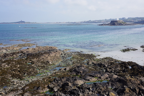
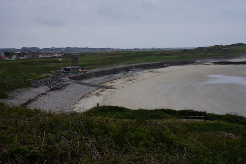
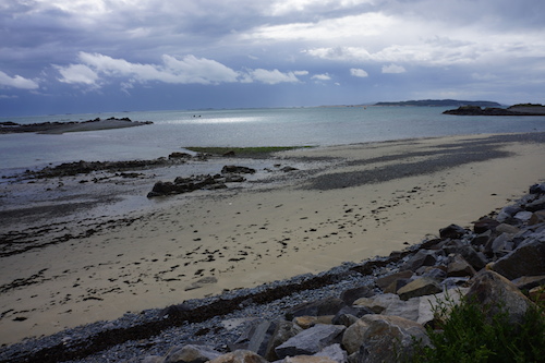
•5 PORTELET HARBOUR – PLEINMONT POINT – PORTELET HARBOUR – FORT GREY – L’ERÉE (my total time 2h59; 312a 296d; net walking time 2h15). This is Walk 7 + 8 in /Dillon/. Fairly good descriptions and map in the book, just follow them closely. Most is obvious. The promised dolmen could not be seen from the road though, and there was no sign. When you reach the trenches keep right, then fork right when you emerge, heading back towards the road on which you came in. Also the map tracing seems to show a path past Fort Saumarez back to the crossroads where the little loop starts. This does not match reality, you are actually on a street here going down to the main road at the marked car park.
•6 FORT PEMBROKE – FORT DOYLE – VALE CHURCH – FORT PEMBROKE (my total time 3h01; 239a 234d; net walking time 2h28). This is Walk 13 in /Dillon/, but starting the loop at Fort Pembroke as in walk 3 above. This is basically an extended version of the same walk, but in reverse. I had hopes this book would be better written and easier to follow and I was right. No huge problems with navigation on this one, this is obviously the book to choose on Guernsey.
• Good starting points: • St. Peter Port – from here the bus will take you around the island, and ferries will take you to Herm and Sark
• How to get there: • By air • By ferry from other Channel Islands
• More info: • Bus timetables can be found at buses.gg • Ferry timetables for Herm can be found at Trident Charter Company • Ferry timetables for Sark can be found at Isle of Sark Shipping Company • Airlines for the Channel Islands are Aurigny, Blue Islands and Flybe
This page was last modified at May 25, 2017.
©2013-2017