Κύθνος – Cyclades
Kythnos is an extremely peaceful and quiet island doing its own thing. Which is mostly farming. And imagine an island with two competing Chóras! The only village with any major tourist appearance is the tiny port. An undeservedly bad-mouthed place which is actually quite pleasant to stay in. But like its neighbor Kea, holiday homes are sprouting even on this island, so things are changing.
Another similarity with its neighbor island is a very bad bus system. Not even the locals seemed to use it, I don’t think anybody knew anything about a potential timetable. The few buses I have seen were empty, except for one doubling up as a school bus. But instead you can walk the roads on Kythnos, at least out of high season traffic is not at a very annoying level (but still do take care).
Not known for being any sort of green island, to say the least, in early June 2007 it still had a fairly greenish appearance. It actually also had a bit of rain. Some happened in May 2023.
The port town Mérihas has an extremely friendly restaurant named Yalos-Byzantio. Several others are also very nice.
Selected walks: For possible walks on this island see Walking, hiking and trekking on KYTHNOS by Raymond Verdoolaege or Travel, Holiday and Visitor Guide for Kythnos, Greece by Foxy’s Island Walks. Road Editions (1:40000) and Anavasi Topo Islands (1:31000) maps exist (see above). The Anavasi map seems to be out of print currently, but I can recommend the “Anavasi mapp”, in other words their “map app”, where you can buy an even more updated version of the original map. If you really want the original map you can still buy it as a PDF-file. When I refer to this map (as /Anavasi/), I am using the “mapp”. Also check out Santorini, Sifnos and the Western & Southern Cyclades by Dieter Graf, referred to below as /Graf/.
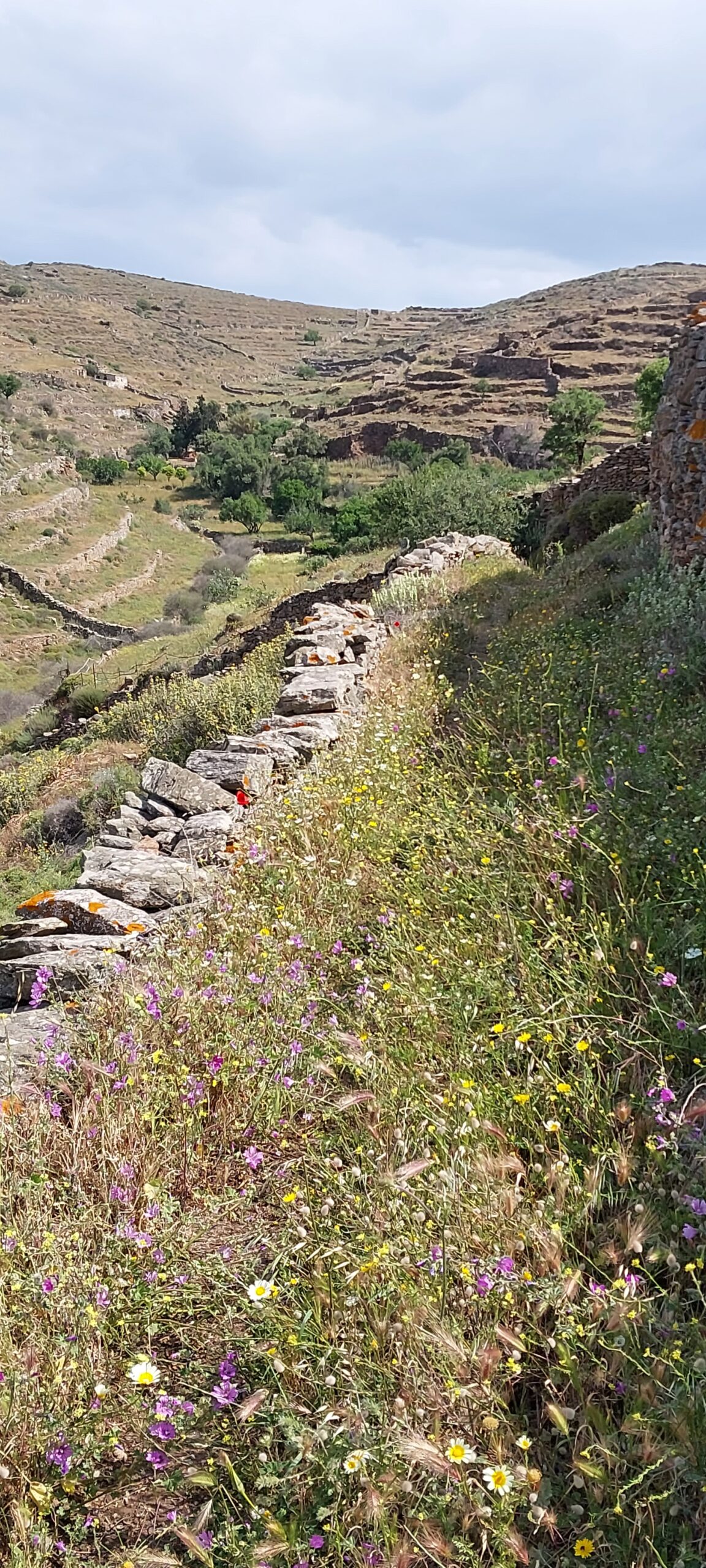
•1 MÉRIHAS – EPISKOPÍ – APOKROÚSSI – KOLÓNA (+ return to MÉRIHAS) (3:41; 19430 steps; 13.34km; alt. gain 535m; alt. loss 526m): The excellent /Anavasi/ map should carry you all the way. Waymarking on Kythnos is VERY sparse, but there is now finally a walkers sign for official walk “6A” pointing down towards Apokroússi.
An optional variation for the return (NOT TESTED SINCE 2007): In 2007 I hunted out an interesting alternative route from Apokroússi by following the initially nice walled footpath around the headland. Very beautiful. Soon you will have to pass some animal pens by scaling a few stone walls using make-shift stiles, then pick up a faint path on the other side. This way you should quite easily get yourself to the dust track above Episkopí. The very last part towards the track is overgrown, below holiday homes, but some sort of path may be possible to identify. At least parts of this walk is also “6A”, however in my experience this does not mean a lot on Kythnos, as paths seem to get little in terms of maintenance and may be (as of 2023) overgrown, impassable or just plain blocked off.
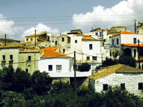
•2 MÉRIHAS – DRIOPÍDA – AG. STÉPHANOS (+ return to MÉRIHAS) (my total time 4h58, includes stops for photography, drinking and a swim in the ocean; +-635m, 2 laps): A stroll along the (partly dusty) roads. You can just follow the road signs, a map is still an advantage. The asphalt road takes a huge detour around Driopída. Instead, walking through the village is possible, but the way will be easier to find on the return, when you have got better orientation. If you want to take the short-cut via the village, just make sure you cross the valley to the northern part of town where you will find the concreted track you will need to be able to continue (quite a challenge to find your way in these labyrinthine streets, the picture above are taken at the point of crossing). When you later, a few minutes after the village, go left at the T-junction with a dusty road you are again on the main route. Choose the route you fancy!
The grassy track going down the valley between the separate parts of Driopída connects with the main road. It starts where you can cross between the southern and the northern part of the village. In other words, yet another possible short-cut.
OBS: I DID THIS WALK LAST IN 2007.
•3 MÉRIHAS – DRIOPÍDA – EPISKOPÍ – MÉRIHAS (3:32; 15292 steps; 12.23km; alt. gain 517m; alt. loss 503m): First of all this is not a walk I can recommend. It became what it was because of me misreading the map. After this I will instead use phone/GPS and the before mentioned “mapp”. My map reading skills seems not to have improved much in the three decades I have been doing “island walking” so it is finally time for me to give in and surrender to modern technology.
After strolling the road up to Driopída I went down to the track in the creek bed, followed it down to the first proper footpath turning off to the right, this was the “obvious” path eventually going towards Episkopí. (The correct path would have been the SECOND proper footpath turning right, I am using it in the other direction in my walk 4 below.) Well it sort of does go to Episkopí, but it is overgrown and even blocked off at the other end. Actually this path is the one used in /Graf/ walk 39, up to more or less the saddle where he turns right towards Chóra. From the saddle I turned left towards Episkopí, only to find myself trapped behind walls and fences. However, it is not far down from this point and you have a dirt track and a farm of sorts ahead of you. Maybe if the vegetation is not blocking the view you can also make out a narrow path in the creek valley on your left. This is your first goal. Going hard left and straight down into this valley will be too steep so find a spot where you can get over the stone wall in front of you more or less safely and slowly make your way ahead and left and descend into the creek valley on animal traces. An animal path leads down into a shady resting place for sheep under a big tree. You might also have the sound of sheep to guide you at this point. Phew! Now that you are in the creek valley you can simply find and follow the narrow path to the right that was maybe spotted from above. It will lead you to the dirt track, where you turn left and you are at Episkopí. There are a couple of gates to pass though, in my case they were closed but not locked. If any of these should be locked you are in trouble. So NOT RECOMMENDED!
•4 MÉRIHAS – MARTINÁKIA – DRIOPÍDA – MÉRIHAS (2:09; 10672 steps; 7.71km; alt. gain 413m; alt. loss 401m): This walk follows the track and path I should have used returning in my walk 3 above. This is official walk 7 marked on /Anavasi/. However I did a short-cut from the start by not walking to road to Episkopí, but instead using a dirt track right at Martinákia marked “Kythnos West”. At the next similar sign you fork right, not following the sign. Soon you will meet the track coming from Episkopí. There are no further navigational issues on this walk, and the path towards Driopída turned out to be superb.
When meeting the track from Driopída, in the creek valley, you of course turn left for the town, I turned right on this occasion just strolling the road back to my starting point. All in all a very nice and not very demanding walk.
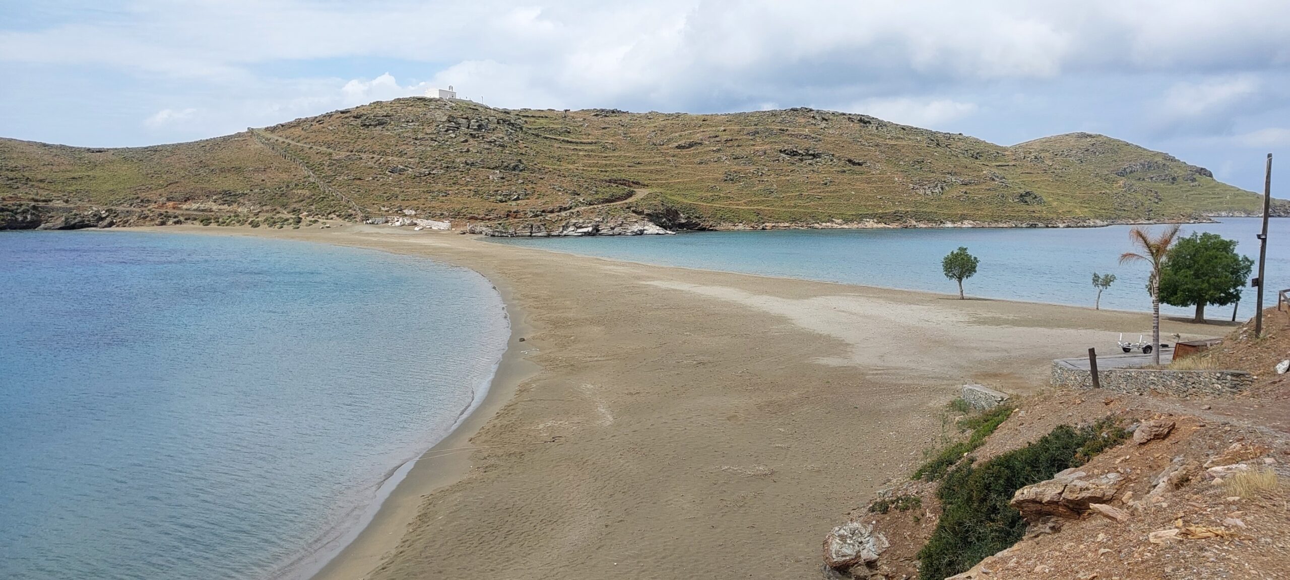
•5 MÉRIHAS – FLAMBOÚRIA – MÉRIHAS (3:44; 17127 steps; 12.00km; alt. gain 517m; alt. loss 495m): From the /Anavasi/ map you will see a track and later a path going from Mérihas to the beach at Flamboúria. Mind that the descent down to the beach is pretty rough and that there is a slightly difficult makeshift fence/gate at the end.
For returning without retracing your steps entirely the only option is unfortunately just the winding road up to the main road where you almost immediately fork left on the continuation of the track you originally used from Mérihas.
Included in my walking time is a small investigation of what you can see as official walk 8 from /Anavasi/ which seemed like an attractive alternative to the road. Unfortunately this path is not maintained and is (attempted…) blocked off at a couple of points and eventually totally overgrown and impassable. Too bad.
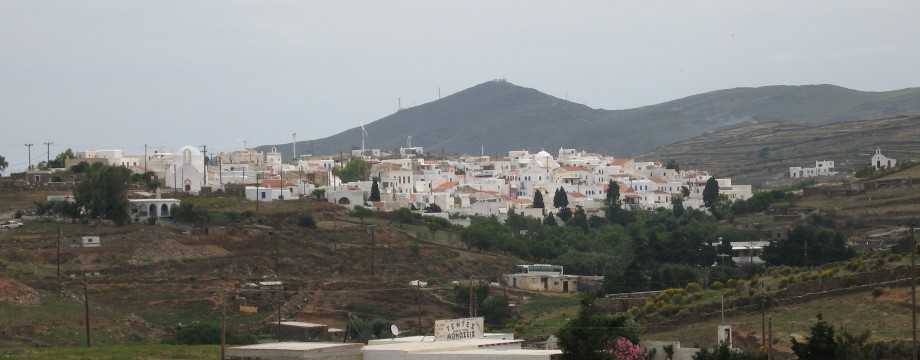
•6 MÉRIHAS – KÝTHNOS (CHÓRA) (1:22; 9533 steps; 7.27km; alt. gain 376m; alt. loss 253m): A brisk walk from the port to the Chóra, following the main road. Not too much traffic, at least not out of high season.
•7 MÉRIHAS – VRYÓKASTRO – MÉRIHAS (2:40; 13481 steps; 8.22km; alt. gain 402m; alt. loss 403m): A short walk from the port to the Vryókastro and back with several options. You can shortcut via the beach at Martinákia or use the road. You can shortcut via the beach and subsequent track at Episkopí or use the road. You can also expand the walk a little by using the “Kythnos West” track I used in my walk 4 above, except when you meet the official walk 7 track you go left to Episkopí. Vryókastro itself (signed!) is part of official walk 6A. My timing follows the “Kythnos West” track out and Episkopí beach on the return.
Vryókastro itself is only semi-interesting and can be extremely windy.
•8 MÉRIHAS – DRIOPÍDA (1:46; 11935 steps; 8.33km; alt. gain 478m; alt. loss 303m): An alternative long walk to Driopída is following the track in the direction of Flamboúria but turning left on the asphalt road, passing the landmark windmills and descending to the town via more or less the top of the island. Can be extremely windy.
• Good starting points: • Mérihas – the port town
• How to get there: • By ferry from other islands in the Cyclades West • By the odd ferry from some islands in the Cyclades Central • By ferry from the mainland
• More info: • Walking, hiking and trekking on KYTHNOS by Raymond Verdoolaege • Travel, Holiday and Visitor Guide for Kythnos, Greece by Foxy’s Island Walks
This page was last modified at May 24, 2023.
©2007-2023 .